Unlocking Innovation, Advancing Sustainability


Join AspenTech at the 18th International Congress and Exposition, whose theme this year is Energy & Sustainability. We look forward to welcoming you to booth #13, where you can meet our experts, watch our presentations and enjoy refreshments in our hospitality corner.
Join us at The 18th International Congress of the Brazilian Geophysical Society & Expogef Booth #13!

Visit us at booth #13!
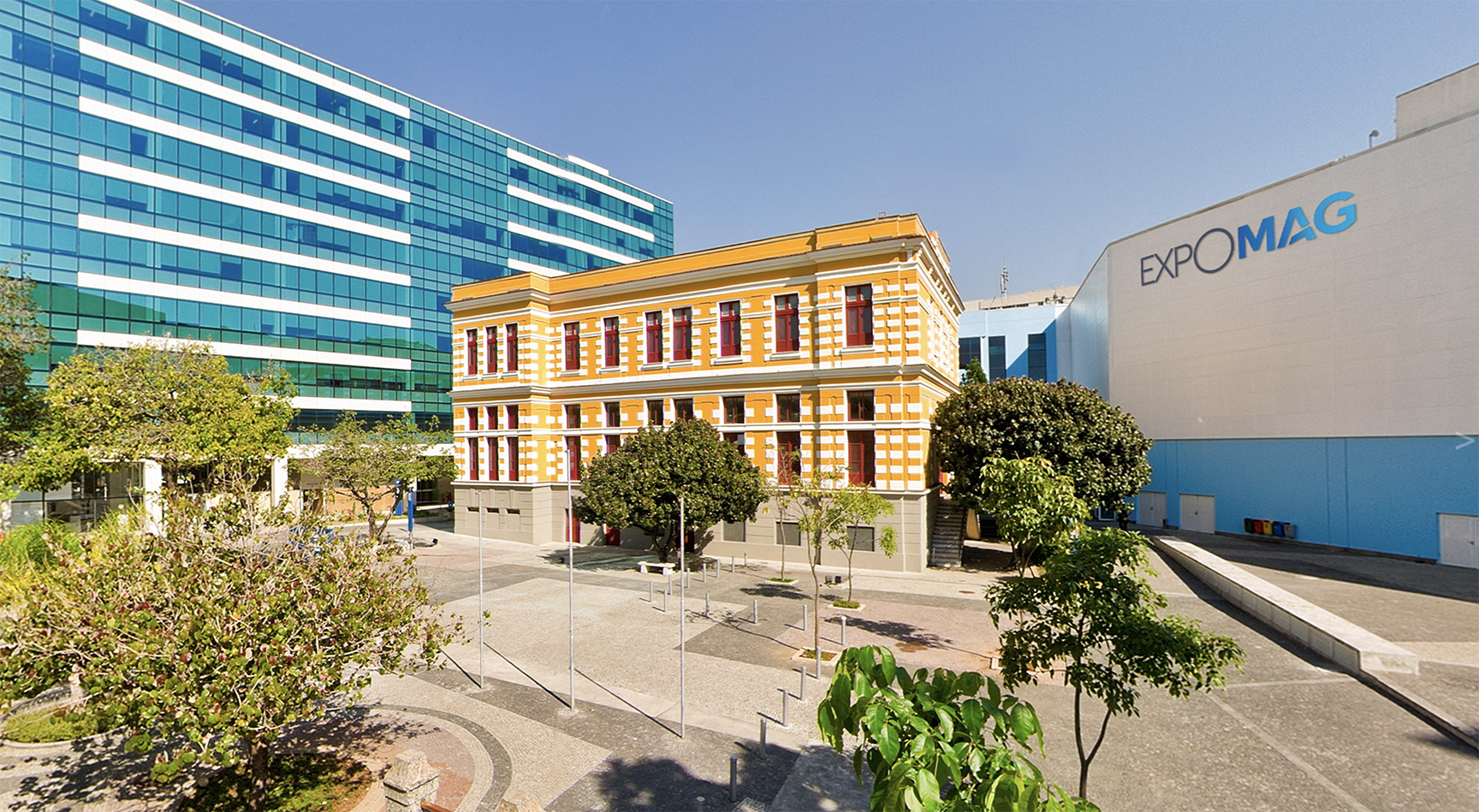
EXPO MAG Convention Center
Featured Tech Sessions
AspenTech SSE Experts in the Technical Program
October 16 -19, 2023 | Rio de Janeiro
EXPO MAG Convention Center
Watch this video to see how AspenTech SSE can help your energy transition!
Our in-booth presentations will cover such timely topics as:
X
Top
Join us
Find us
Learn more

Fast Stochastic Inversion: An Improved Seismic Inversion Method
An Integrated Workflow for Capturing and Modeling Structural Uncertainties
Rock Type Classification: AI Well and Seismic Integration for Facies Prediction
Advanced Seismic Multi-Azimuth Analysis
OSDU and Geoscience Workflow Enablement: AspenTech Strategy on Top of OSDU
And many others...
Presentation Schedule
Click here to
download our
detailed
Presentation Schedule
Stay Ahead of the Energy Transition with the
Technology Leader in Subsurface Knowledge

Want to learn more about AspenTech?
Meet the new AspenTech!
For over 35 years, the AspenTech Subsurface Science and Engineering group (formerly Paradigm™ and Roxar™) has been a pioneer in providing software that helps companies maximize the value of their end-to-end subsurface operations. Our innovative technologies, aimed at both traditional oil and gas operators as well as today’s energy transition industries, including CCS/CCUS and geothermal, enable you to optimize asset management, gain deeper insight into your operations and identify the best development scenarios, while minimizing risk across your geoscience and engineering processes.
Learn how we can help you exceed your operational excellence and sustainability goals!


View Now
The Aspen EarthStudy 360 full-azimuth imaging and characterization system provides 360 degrees of insight into the subsurface. The system is designed to deliver a complete set of data that enables geoscientists to obtain accurate subsurface velocity models, structural attributes, medium properties and reservoir characteristics.
Brochure:
Aspen EarthStudy 360™

View Now
Aspen SeisEarth is a one-stop shop for interpreters. This integrated solution suite provides fast, multi-survey structural and stratigraphic interpretation and visualization from regional to reservoir, enabling multiple users to collaborate in a single shared environment.
Brochure:
Aspen SeisEarth™

View Now
This article shows how a machine-learning workflow based on a Self-Growing Neural Network (SGNN) was used by Aspen SeisEarth™ as an efficient and unbiased scanning tool for carbon capture and storage (CCS) monitoring, enabling faster identification of the confinement system.
Article:
Using a Self-growing Neural Network Approach to CCS Monitoring


View Now
Read this case study to learn how Aspen SKUA™
is used by Calpine Corporation to create a highly constrained and continually refined 3D structural model that assists with water injection and steam production well planning, reservoir management, drilling analysis, and a better understanding of induced seismicity.
Case Study:
Aspen SKUA™ Provides Deeper Insight for The Geysers, One of the World's Largest Geothermal Systems
View Now
Discover how Aspen RMS 3D modeling software, an industry-leading geoscience and reservoir engineering collaboration platform, enables faster, more robust and reliable production models, improved decision making, more justifiable investments and enhanced field performance, leading to higher recovery rates in even the most complex reservoirs.
Brochure:
Aspen RMS™
View Now
In a mature onshore North American Basin with
a wealth of information, an operator needed to streamline data integration and interpretation in order to enable efficient prospecting. Read how Aspen SKUA™ software was used to develop multiple custom-made macros to automate repetitive and time-consuming tasks, and to create a new mapping workflow that enabled the customer to efficiently create prospecting maps to assist in the strategic acquisition of oil and
gas leases.
Case Study:
Efficient Data Integration, Visualization and Mapping in a Mature Basin Lead to Interpretation of New Prospects
View Now
Upstream companies today must achieve operational excellence by reducing emissions and utility demands, improving production at existing assets and replacing and expanding reserves while exhibiting capital discipline. Gain insights on end-to-end digital solutions, spanning the subsurface to the well to the gathering network to the processing infrastructure, uniquely providing the upstream operator with the ability to optimize production across the entire value chain.
White Paper:
Near-Field Exploration and Development: A Holistic Look at Leveraging Digital Technologies to Increase Productivity and Profitablilty


View this section to learn how we can help you exceed your operational excellence and sustainability goals!


See how AspenTech partners with the Open Group OSDU Forum.
Gain deeper insights into how to apply AspenTech geoscience solutions at one of our 40-minute workshops. Subject Matter Experts will guide you through an Integrated Workflow for Fast Seismic Interpretation.
NEW this year – Hands-On, In-Booth Workshop!
Join us on the exhibit floor – Booth #13


Despite the fact that the salt section in the Santos Basin is well studied in terms of compressional velocity and its related applications, such as seismic acquisition design, seismic processing, depth forecast uncertainties, geomechanical, geohazard and safety drilling, there is a lack of knowledge regarding the post-salt portions of this basin regarding this property, especially when dealing with carbonates in the Albian-Cenomanian portion. In the Campos Basin, where the Albian-Cenomanian is more prominent, we did some studies, taking into account the sedimentary aspects of this portion, mainly researching the geological/structural processes involved in the feature records. Recently we saw a singular study commenting about the carbonate raft behaviors in a field portion of the Campos Basin, pointing out the necessity of incorporating more geological knowledge to build a feasible compressional velocity model, honoring the observed geology. The idea of the present study is to split the Albian-Cenomanian portion of the Santos Basin into three parts: proximal, intermedial and distal, and describe the main sedimentary records, facies and logging
Dealing with the Albian-Cenomanian of the Santos Basin, and Possible Implications in Terms of Compressional Velocity Model and the Related Applications
Presented by:
Vitor Novellino - Petrobras, Universidade Federal Fluminense | Fernando Freire - Universidade Federal Fluminense
Alexandre Maul – Petrobras | María González – AspenTech
Semi-Automatic Interpretation of Intra-Alagoas Unconformity: A Case Study in the Pre-Salt Layer of Atapu Field
Presented by:
Lívia Lovatte Fonseca - Universidade Federal Fluminense, Ies Brazil | Gabriela Figueiredo Marinho - Universidade Federal Fluminense, AspenTech
Wagner Moreira Lupinacci - Universidade Federal Fluminense, INCT-GP
Challenges in Velocity Model Building in Areas with Carbonate Rafts: A Case Study in the Campos Basin
Presented by:
Gisele Camargo - Petrobras, UERJ | María González - AspenTech | Filipe Borges and Alexandre Maul - Petrobras | Webster Mohriak - UERJ

Seismic imaging relies on accurate velocity models, particularly in areas with complex geological structures. In the Campos Basin, the sedimentary layer above the pre-salt reservoirs displays significant heterogeneity due to raft tectonics, resulting in the juxtaposition of salt domes, carbonate rafts, and siliciclastic sediments. In this study, we propose several alternative velocity models for the Marlim Complex area, specifically focusing on the carbonate rafts. We compare these
models to the standard velocity model built during processing in terms
Session Theme: Velocity Modeling & Uncertainties Date and Time: October 19, 14:00 Room: Barra
Session Theme: Reservoir Features & Behaviors Date and Time: October 18, 10:00 Room: Botafogo
Accurate characterization of hydrocarbon reservoirs below complex geological areas is essential in the exploration and production stages. With recent advances in seismic acquisition, companies have raised data acquisition to a new level, acquiring multi-azimuth data that provide valuable information for seismic interpretation, imaging and modeling, leading to a better characterization of such reservoirs. Several approaches have been suggested on how to manage such data in interpretation projects, how to perform a joint interpretation considering all available directions, and even more importantly, how to extract anisotropic information about the region of interest. Anisotropic effects can be noted as azimuthal variations in seismic
How to Practically Chase for Anisotropic Evidence in Multi-Azimuth Seismic Data
Presented by: João Muniz and Vinicius Ramos - AspenTech
Session: Velocity Modeling & Uncertainties Date and Time: October 19, 14:25 Room: Barra
signatures when available. Then, with the existing sonic information, infer the geologic compressional velocity distribution in a 3D way, to propose distinct scenarios for the compressional velocity of this portion, trying to respect the known geology. To support any decision, we will present several statistical analyses for both geological facies and compressional velocity. The generated compressional velocity models were tested in the simplest way, by evaluating the sensibility of gross-rock volume (GRV) above a chosen reference, always comparing to a standard model – the one delivered for the seismic migration process, and all considering the same inputs for depth calibration. We believe this proposed approach is part of the newest innovation in providing reliable compressional velocity models to be added to the ones already observed for the salt section, to push better seismic migration images in complex areas. The pre-salt reservoirs in the Campos and Santos basins need these detailed compressional velocity models, and we hope to contribute with this challenging aspect.
of their accuracy for forecasting reservoir depth and calculating the Gross-Rock Volume (GRV) of pre-salt reservoirs. Our results reveal that even well-calibrated, geologically constrained models can yield considerable variations in pre-salt reservoir topography. As the velocity model is a crucial input for various reservoir characterization workflows, it plays a crucial role in uncertainty analysis and deserves therefore a more detailed analysis.
velocity field and amplitude distribution. By analyzing these azimuthal variations along prestack and poststack seismic data, it is possible to derive the description of the anisotropic field. Anisotropic signatures are mainly related to naturally occurring fractures, and we can learn from traveltime variations about the nature of the fractures. In this study, different approaches will be applied to identify regions with anisotropic behavior, which will be extracted from the isotropic background, and later deeply characterized to provide detailed information about the fracture field to improve reservoir characterization and ensure accuracy of advanced flow simulation, thus reducing exploration and production risks.
The pre-salt reservoirs are inserted in a context of great complexity, with high depths, thick overlayed salt and inherent heterogeneity of carbonate rocks. Such factors contribute to the low resolution of the seismic data, making the seismic interpretation process very challenging. These difficulties require technologies that support conventional methods of reservoir characterization. Recognition of intra-Alagoas unconformity (IAU) is considered a challenge in stratigraphic studies of the Santos Basin, since its reflector does not have great lateral continuity and is often eroded by the salt base. The importance of the IAU is related to the geological framework that it configures, being a transgressive surface, in the transition from the rift phase to the post-rift phase, marking the beginning of a phase of greater tectonic quiescence and subdividing the Barra Velha Formation (Fm) into lower and upper.
The objective of this work was to evaluate the applicability of recognizing the IAU through semi-automatic methods. The proposed methodology identifies the main stratigraphic surfaces internal to the Barra Velha Fm. in the Atapu field, an important oil-producing field in Santos Basin, Brazil. The methodology consisted of two stages: interpretation of the main unconformities and faults of the pre-salt play and generation of a structural model and the semi-automatic recognition of the internal reflectors of the Barra Velha Fm. through the workflow proposed by Aspen SKUA™ software.
This second phase began with the insertion of seeds, points uniformly distributed throughout the seismic data that, based on parameters that define the horizontal and vertical distances between them, will propagate the information from that point to the volume through the seismic propagator method. The result of this step was the recognition of three intra-formational horizons, the patches, including the one corresponding to the IAU. This identification was based on patterns such as high positive amplitude values, poor lateral continuity, and erosive truncation termination in the upper reflectors. The result of this automatic recognition was not successful in half of the studied area, due to the presence of faults, the low resolution of the seismic data or erosion. Thus, it was necessary to manually insert the seeds and generate new patches in these regions where propagation failed. At the end of this stage, the horizon still showed areas without data, but through seismic sections, we verified that these were regions where IAU was eroded. The location of these regions compared to the basement map revealed a direct link between the structural highs present in the field and the processes that eroded the IAU, suggesting that the uplift of the pre-salt section was sufficient to expose the sediments and to have erosion processes and possibly reworking. Therefore, the use of the semi-automatic interpretation tool proved to be efficient in places where the reflector presents good continuity. However, in areas of low seismic data resolution, it was necessary to manually force the propagation.
Session: Reservoir II Date and Time: October 18, 10:00 Room: Poster
Session Theme: AI Modeling & Uncertainties Date and Time: October 18, 15:55 Room: Leblon
possible redundancies in their responses and highlight data heterogenies. Finally, for the classification, a model was trained and
a facies volume from the Oligocene to Recent was generated. In this volume, a notable distinction was observed among four prominent facies, with one of them being specifically associated with amalgamated turbidite channel systems. These systems could represent a significant risk to drilling operations due to their complex nature, including rapid changes in sedimentary characteristics, the potential for fluid flow pathways, and the risk of encountering high-pressure zones. The distribution of this facies shows a notable variation, becoming more abundant in lower portions and gradually diminishing, confined to southern regions of the study area.
The analysis of turbidite facies distribution, together with the interpretation of the seafloor map, allowed the delineation of high-risk zones and the identification of regions with interposition of the turbidite system facies with submarine canyons and ravines from
the seafloor map.
Mapping submarine hazards is a fundamental step in drilling operations, for both mitigating risk and optimizing well placement. In the deep waters of the Ceará Basin, the limited well information and geological complexity observed in several stratigraphic intervals pose significant obstacles to an accurate geological prediction. In such situations, seismic data can play a significant role in extracting relevant information for submarine hazard analysis.
The proposed study is based on the implementation of an unsupervised classification workflow for mapping potential drilling risk zones in a shallow interval of the Ceará Basin, delimited in the Mundaú sub-basin. Input includes a seismic volume reprocessed in 2012 and a well dataset used for quality control. The classification process uses an unsupervised method based on neural network (Growing Neural Gas, Fritzke (1995)) and was divided into three steps. First, seismic attributes were generated from the original amplitude data, and later used as input for subsequent PCA analysis. In the second step, a study of the variance of each seismic attribut was conducted to reduce
Unsupervised Facies Classification for Submarine Hazards Mapping: A Case Study from Deep Waters of the Ceará Basin
Presented by:
João Victor Anjos and Vinicius Ramos Pinto - AspenTech | Cleverson Guizan - Universidade Federal Fluminense
Session Theme: Ocean Bottom Nodes Date and Time: October 17, 15:55 Room: Urca
Tupi Ocean Bottom Nodes Diffraction Imaging: Challenges and Opportunities in Using Full-Azimuth Local Angle Domain for Reservoir Characterization
Presented by:
Danielle Marques, Diego Potomati, Nathalia Martinho, Pedro Silvany, Mário Paes, José Marcelo Cruz - Petrobras | Caio Barros - AspenTech
The Tupi field is one of the major pre-salt oil producers, located in Santos Basin approximately 300 km off the coast of Rio de Janeiro, Brazil. The pioneering Tupi Ocean Bottom Nodes (OBN) acquisition encourages the application of the latest seismic processing and imaging technologies that benefit from the survey’s full azimuth, long offset, and broadband acquisition (Cruz et al., 2021, Cruz, 2021). The Full-Azimuth Local Angle Domain (LAD) migration is an alternative
imaging technology. The method generates in-situ, full-azimuth reflectivity and directivity image gathers from the recorded seismic wavefield. The directivity gathers were used to create diffraction imaging and preferentially “weight” certain types of energy in the recorded wavefield to identify and highlight subsurface features that were difficult to recover with standard imaging methods.


View Now
One of the key challenges in accelerating decision-making and reducing the development cycle of any operational E&P prospect is to seamlessly share the same updated data with all parties involved in the project. An Aspen Geolog-OSDU Connector was built by the AspenTech SSE team in close collaboration with TotalEnergies. Read more to learn how after end-to-end tests were performed in TotalEnergies’ development and qualification environments, the connector was recognized by the customer as a fit-for-purpose solution that met the expectations of
the end users.
Case Study: Aspen Geolog™ Connector to OSDU Helps Total Energies Accelerate Decision-Making and Project Delivery
To reserve your seat at one of the workshops, please fill out this brief form.