
Discover Local:
Hiking and Outdoor Adventures
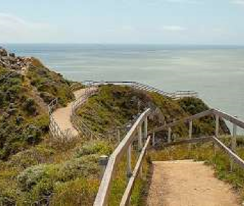
The Bay Area has 7,500 miles of hiking trails. No matter where you live, there is a trailhead within range leading to a mountaintop, beach, redwood grove, waterfall or lake.
Hundreds of world-class outdoor destinations across the region await your discovery. What are you waiting for?
Local Adventures from The Chronicle


Sponsored story A
Read More
Read More
Sponsored story B
Read More
Sponsored story C
Read More
Sponsored story D


LOCAL // BAY AREA & STATE
Read More
Hike-in campsites reopening around the
Bay Area
TRAVEL
Read More
Sunday Getaway: Windy Hill, Santa Cruz Mountains

CULTURE DESK // TOM STIENSTRA
Read More
How to take advantage
of national parks in California during pandemic
CULTURE DESK // SUNDAY DRIVE
Read More
Sunday Getaway to Loma Alta Preserve in Marin County


TRAVEL
Read More
Top 10 Bay Area Hikes During Shelter-In-Place
LOCAL // BAY AREA & STATE
Read More
Looking for summer solitude? Marble Mountain is the perfect retreat

LOCAL // BAY AREA & STATE
Read More
Sutro Baths, more parks reopen around Bay Area

Map
The Chronicle has mapped out a comprehensive list of parks, beaches and nature trails in the Bay Area and Northern California with the status of each place —
letting you know if the area is open to the public, has visitation restrictions
or is closed until further notice.
SPONSORED: Featured Partners

Read More
Sponsored story D
Read More
Sponsored story B
Read More
Sponsored story A
Read More
Sponsored story C

Sweepstakes


0 WINNER
ENDS 8- 15-2020
11 DAYS LEFT
11 DAYS LEFT


See the full map here


TRAVEL
Read More
8 ways to rediscover the Bay Area’s beauty during pandemic

SPECIAL REPORT
Read More
Where to hike, run,
and get outside right now in the Bay Area
TRAVEL
Read More
Mt. Tam is peak staycation option for outdoor travel

Sponsored: Stories
TRAVEL
Read More
Which outdoor areas
are open, closed around the Bay Area going
into August
More Chronicle Coverage


Pierce Ranch, Point Reyes National Seashore
Parking open, Tomales Point Trail open to see elk, views of ocean and Tomales Bay
Read More

Skyline Wilderness Park
Trail to Lake Marie crowns surprise pretty routes east of Napa
Read More

Read More

Read More

Mcnears Beach
Pretty park along shoreline of San Pablo Bay
Read More
Muir Beach Overlook
Parking, short trail re-opened to spectacular coastal overlook
Read More

Black Diamond Minesregional Park
Park at Sydney Flat; upper parking, visitor center, tours closed
Read More

Pier 52 Boat Launch
Small boat ramp for access to bay south of Bay Bridge
Read More

Don Castro Reservoir
Hiking, shorefishing;
no swimming at lagoon
Read More

Crystal Springs Regional Trail
Popular paved trail, 15-mph speed limit for cyclists,
routed along Crystal Springs,
San Andreas reservoirs
Read More

Coyote Hills Regional Park
Former Native American sites on shore of South Bay
Read More

Pescadero State Beach
Parking re-opened for small beach areas, nearby reefs, gorgeous sunsets
Read More

Pearson-Arastradero Preserve
From parking, walks across road to trail that rises up to pretty Arastradero Lake
Read More

Joseph D. Grant County Park
Parking, trails open; campground closed
Read More

Saratoga Gap Open Space Preserve
Short trail provides access to adjoining preserves
Read More
Stafford Lake
Limited parking for access to lake, shorefishing; picnic areas, playground, restrooms closed
Drakes Estero, Point Reyes National Seashore
Trail leads to Drakes Estero, across coastal hills for panorama of Estero, to little-known beach


SHARE A MEMORABLE MOMENT +
Enter for a chance to win:
Sony-Alpha a6000 Mirrorless Camera + $250 Gift Card


6 places to stargaze around the Bay Area during coronavirus
Read More
sf chronicle
sf chronicle
Read More
Santa Cruz’s rail trail inches towards completion

Most Bay Area parks reopen, including East Bay lakes
sf chronicle
Read More
6 places to stargaze around the Bay Area during coronavirus
Read More
sf chronicle
sf chronicle
Read More
Santa Cruz’s rail trail inches towards completion
sf chronicle
Read More
Most Bay Area parks reopen, including East Bay lakes