All Langan Products


Digital Solutions
Bridging Data and Space for
Operational Excellence
Accelerate decision-making with unified, location-aware systems
Improve responsiveness to change, whether day-to-day operations or large-scale shifts
Build a smarter workplace strategy grounded in actionable insights
Break down silos between departments managing space and facilities
Align location-enabled data with operational needs for better planning and decision support

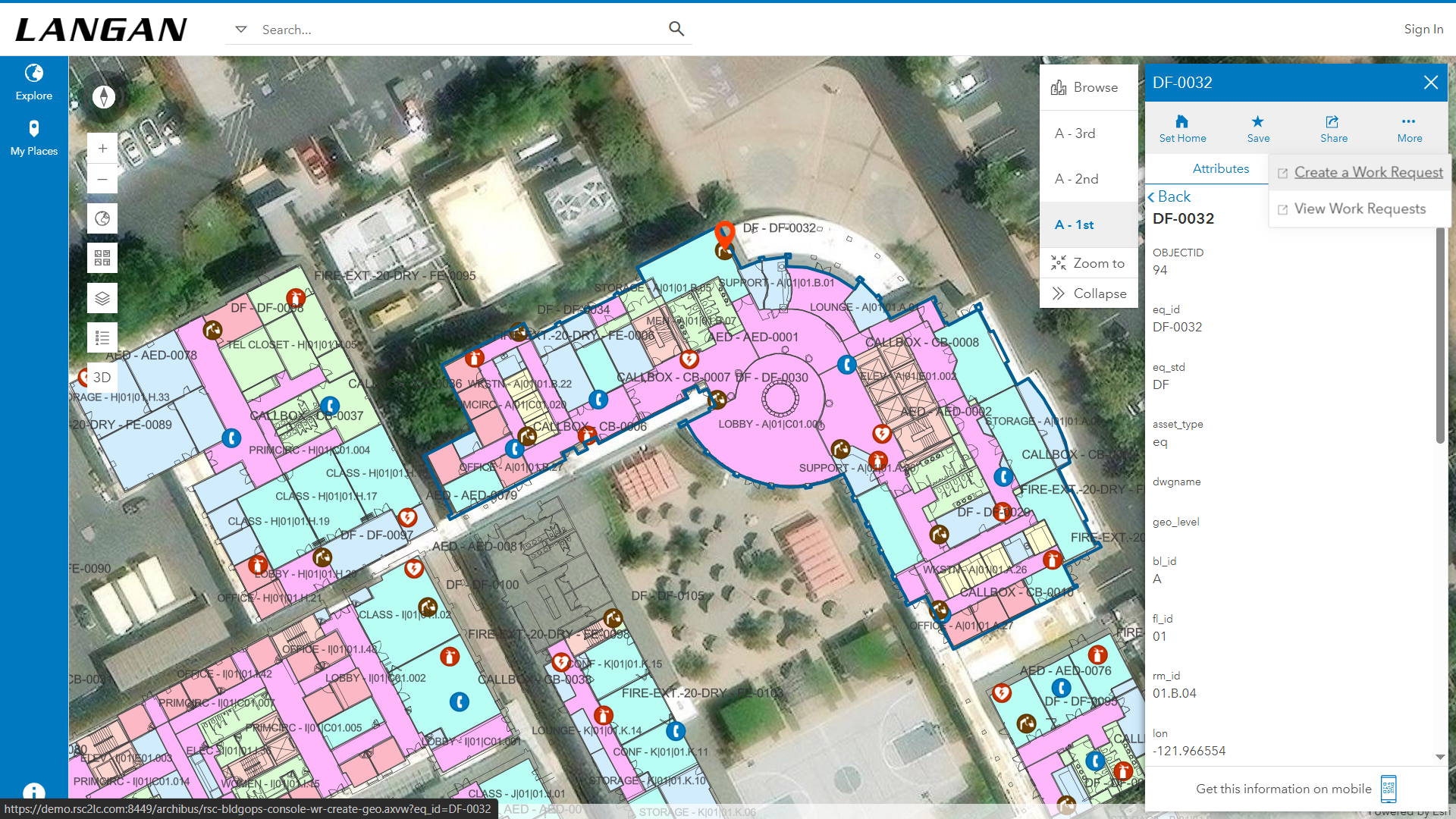
Langan’s IndoorFusionTM seamlessly connects Esri’s ArcGIS Indoors with your IWMS (e.g., Archibus by Eptura, Nuvolo—a ServiceNow Solution Provider, etc.), transforming how organizations manage space, assets, and operations. By unifying GIS and IWMS, it bridges the as-built-to-operations gap, unlocking new levels of analysis, insight, and reporting across facilities and portfolios. This integration empowers teams to make faster, smarter decisions rooted in location intelligence.
- ABOUT INDOORFUSIONTM -

Powerful Integration,
Smarter Space.
REQUEST A DEMO
IndoorFusionTM isn’t just a connector, it’s the foundation for a more intelligent, spatially aware way to manage the built environment.
PRO - CUSTOM QUOTE
CORE FUNCTIONALITY
INDOOR LOCATION
INTELLIGENCE
ACCELERATED RESPONSE
& PLANNING
ASSET TRACKING &�DATA ENRICHMENT
OPTIMIZED FIELD OPERATIONS
ADVANCED ANALYTICS
& REPORTING
DIGITAL TWINS &�STRATEGIC PLANNING
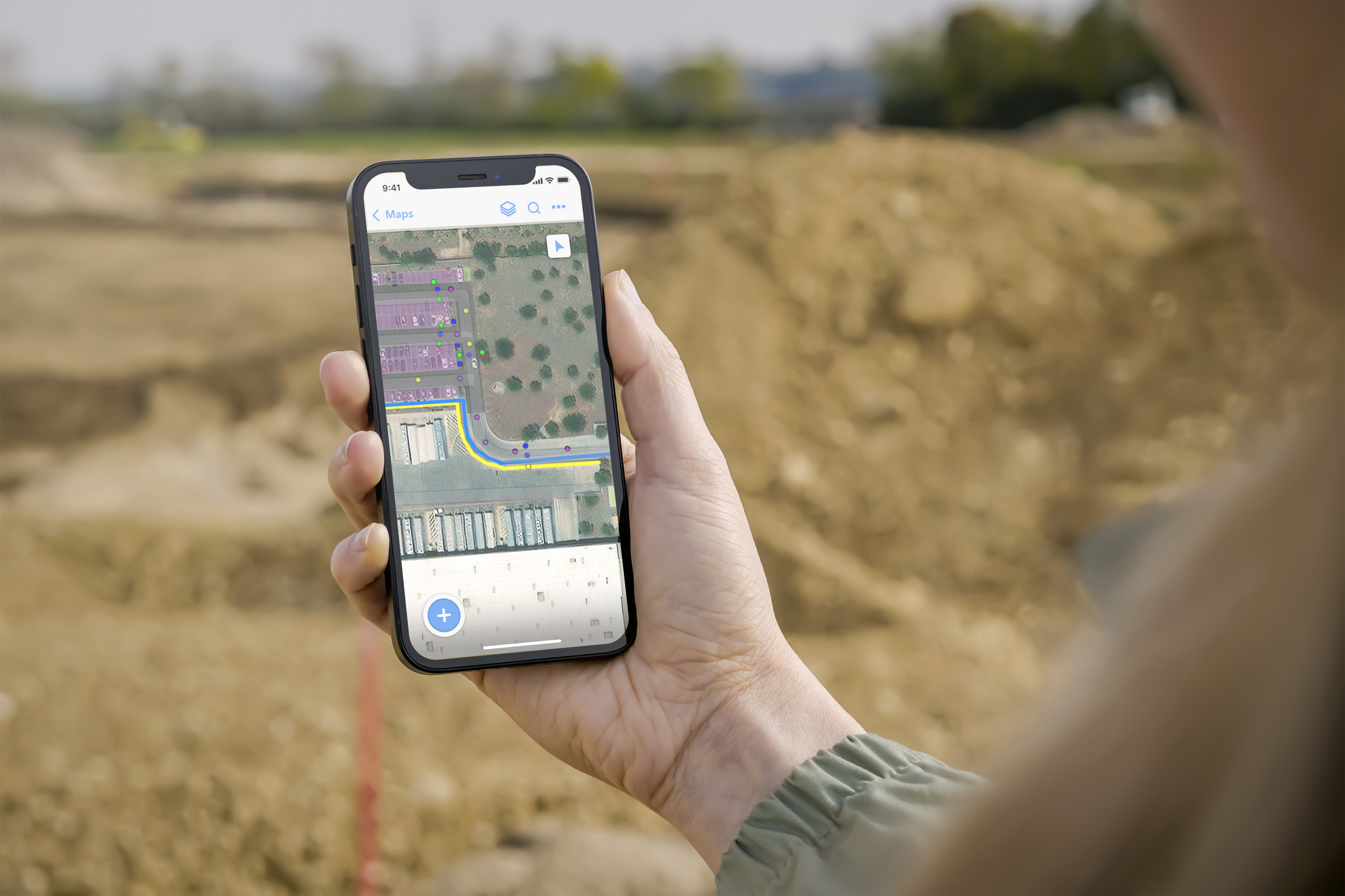
INDOOR-OUTDOOR ROUTING
VALUE DELIVERED
Visualize, analyze, and interact with indoor space and asset data in 2D/3D maps integrated with IWMS apps. Achieve enhanced navigation and asset management within buildings and across portfolios.
Enable teams to locate people, places, and assets quickly, assign tasks efficiently, and plan scenarios to optimize workflow.
Capture asset data via location-enabled mobile apps or autonomously via IoT sensors in GIS and sync with IWMS for improved decision support.
Support federal and enterprise initiatives with optimized route planning and navigation for field technicians.
Access dynamic 2D/3D maps and location analytics with integrated reporting tools to monitor, plan, and optimize operations regardless of portfolio size or location.
Use digital twins to simulate and plan work within individual buildings and across an entire campus or portfolio.
Optimize routes and response times for unplanned events, work orders, inspections, and emergency planning.
Core Functionality & Value

User flexibility
allows work in ArcGIS
or your IWMS

Facility operations
streamline access
to critical data


Multi-point routing & wayfinding
guides users through indoor and outdoor locations


Rich visualization
shows data in clear
2D and 3D maps

Advanced search
finds rooms, assets,�and spaces fast

Seamless integration
connects ArcGIS with your IWMS for unified workflows
KEY BENEFITS


ABOUT THE PRODUCT
CONTACT US


REQUEST A DEMO


- ABOUT THE PRODUCT -
Pricing
Base pricing for the IndoorFusionTM connector is $35,000 USD. �Please inquire directly at the 'Contact Us' button below for complete pricing and requirements.


Watch
Product Overview

Limited Time Offer:�Save $10K on IndoorFusionTM
IndoorFusionTM connects your GIS and IWMS systems to deliver a�unified view of your facilities, space, and assets.��For a limited time, purchase the IndoorFusionTM base subscription for $25K.
Contact digitalsolutions@langan.com
Offer valid through June 30, 2026.�Annual base subscription of $35K will apply after year one.

Get started for $25K

Limited Time Offer: Save $10K on IndoorFusionTM
For a limited time, purchase the IndoorFusionTM base subscription for $25K. Annual base subscription of $35K will apply after year one. �Offer valid through June 30, 2026.�
Contact digitalsolutions@langan.com