

Get a Quote

LITE
Starting at $8,000
May have no GIS currently
Looking for digital data
Up to 5 basic attributes

STANDARD
Starting at $15,000
Have existing GIS data/ applications
Familiar with GIS tools
Need enhanced�access to data
Up to 10 attributes
PRO
Custom Quote
Utility network functionality
Advanced
modeling capabilities
Real-time data insights
Field-enabled applications
for entire workforce
Integration multiple platforms
10+ attributes for
integration and modeling
Base pricing for the HydroSuiteTM is $8,000 USD. �Please inquire directly at the 'Request A Quote' button below for complete pricing and requirements.


PRICING
Core Functionality & Value
You need a solution that keeps up with you and your needs. Dig deeper to see how HydroSuite provides value to your business.
Learn More
Future-proof your tech
with open, scalable architecture


Unify teams
on shared live maps


Plan capital projects faster
with scenario modeling


Extend asset life
through smarter maintenance


Stay audit-ready
with instant reports�of asset inspections


Reduce outages
with predictive analytics


KEY BENEFITS
A Future-Ready Platform for Utility Management
Elimination of data silos by enabling to work from the same live network model-eliminating multiple sources of data and version confusion.
Built on Esri® ArcGIS Enterprise, it supports full on-prem, cloud, or hybrid deployments-providing flexibility and full compatibility.
Live digital access on desktop and mobile devices to quickly access water, sewer, and stormwater-related utility data.
See More >
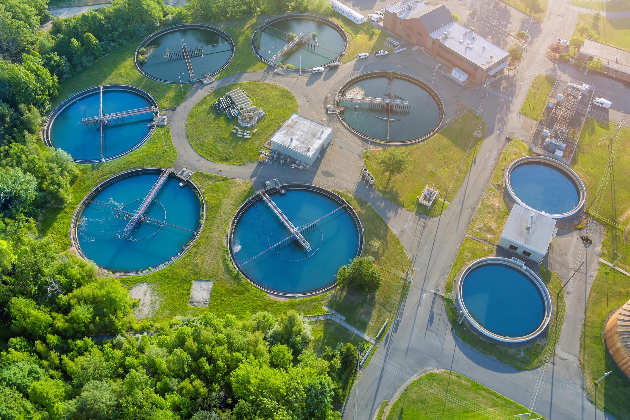
WATER
SEWER
STORM
Optimize Operations and �Manage Water Systems Effectively
REQUEST A DEMO
Langan HydroSuiteTM is a next-generation platform that combines high-resolution GIS data with robust field tools to give utilities a single,�real-time source of truth for water, sewer, and stormwater systems.
- ABOUT THE PRODUCT -

Sewer Module
Data Migration to Utility Network: Facilitates transition from legacy geometric networks to Esri’s Utility Network for enhanced data modeling and connectivity.
Condition Assessment & Reporting: Supports integration of CCTV and other inspection data for condition analysis and asset lifecycle planning.
Network Mapping & Maintenance: Provides tools for mapping sewer networks, tracking maintenance activities, and managing inspection workflows.


CORE FUNCTIONALITY
VALUE DELIVERED
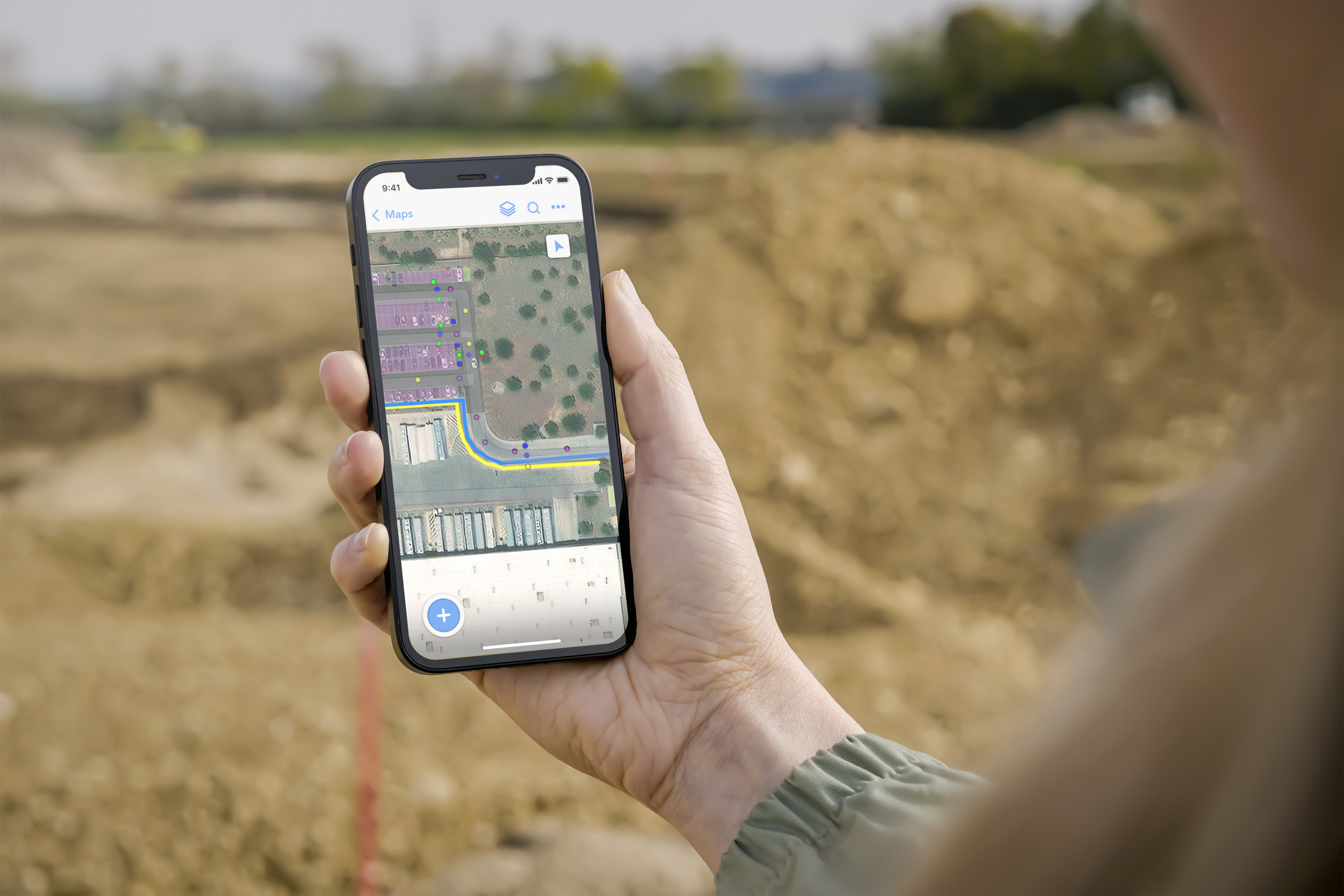
TRUE MOBILITY�—ONLINE & OFFLINE
Native iOS/Android apps cache maps, asset photos, and inspection forms, keeping crews productive—even in dead zones.
WORK-ORDER�& CMMS INTEGRATION
SMART INSPECTIONS
DOCUMENT VAULT
INTUITIVE USER INTERFACE
ANALYTICS & DASHBOARDS
Two-way sync with Cityworks, Cartegraph, Lucity, Maximo, and more. Asset history in the field and triggerwork orders directly from the map..
Configurable forms with barcode/QR scanning, voice-to-text, and photo markup push data straight into the master database.
DIGITAL-TWIN READY
SECURITY & COMPLIANCE
ESRI-NATIVE ARCHITECTURE
Link as-builts, CCTV videos, permits, and SOPs to any asset; no more digging through network drives.
A user friendly interface allows users from every department and every skill level to gain increased access to powerful data.
Out-of-the-box KPIs for leakage, SSOs, infiltration hotspots, storm-water capacity, and maintenance backlog.
Out-of-the-box 3D capabilities allow providers the framework to start building their network digital twin.
Role-based access, encryption (in-flight and at-rest), automatic change logs, and configurable retention policies ensure secure and compliant operations.
Leverages ArcGIS Enterprise & Utility Network for high-fidelity topology, advanced trace analytics, and seamless Esri extension support.


WATER
SEWER
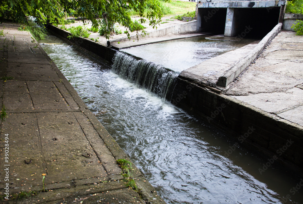
Stormwater Module
Maintenance Scheduling: Enables proactive scheduling and tracking of stormwater system maintenance to prevent blockages and overflows.
Flood Risk Analysis: Leverages GIS tools to model flood scenarios and assess impacts on infrastructure and communities.
Stormwater Asset Management: Tracks infrastructure such as catch basins, culverts, and detention basins with spatial and non-spatial data integration.
STORM
Seamless integration with your existing Esri infrastructure and partner solutions, so your teams’ tools, skills, and licenses remain in full force.
From Static Maps to Smart Networks

Turn assets into intelligence. Every pipe, manhole, and outfall becomes a data-rich, sensor-ready asset that feeds live inspections, work orders, and predictive maintenance.
Decide faster, comply easier. Integrated records and real-time updates slash reporting efforts and keep regulators satisfied.
Step toward a full digital twin. History, telemetry, and GIS unite to power leak-probability heat maps, optimized valve-isolation plans, and long-range capital forecasts, all in one intuitive dashboard.
All Langan Products


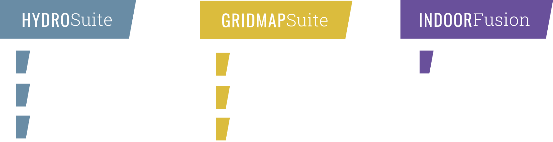
Digital Solutions


Technical Excellence | Practical Experience | Client Responsiveness


KEY BENEFITS
core functionality
value delivered
TRUE MOBILITY—�ONLINE & OFFLINE
WORK-ORDER�& CMMS INTEGRATION
SMART INSPECTIONS
DOCUMENT VAULT
INTUITIVE USER INTERFACE
ANALYTICS & DASHBOARDS
DIGITAL-TWIN READY
SECURITY & COMPLIANCE
ESRI-NATIVE ARCHITECTURE
Native iOS/Android apps cache maps, asset photos, and inspection forms, keeping crews productive—even in dead zones.
Two-way sync with Cityworks, Cartegraph, Lucity, Maximo, and more. Asset history in the field and trigger work orders directly from the map.
Configurable forms with barcode/QR scanning, voice-to-text, and photo markup push data straight into the master database.
Link as-builts, CCTV videos, permits, and SOPs to any asset—no more digging through network drives.
A user-friendly interface allows users from every department and every skill level to gain increased access to powerful data.
Out-of-the-box KPIs for leakage, SSOs, infiltration hotspots, stormwater capacity, and maintenance backlog.
Out-of-the-box 3D capabilities allow providers the framework to start building their network digital twin.
Role-based access, encryption (in-flight and at-rest), automatic change logs, and configurable retention policies enable secure and compliant operations.
Leverages ArcGIS Enterprise & Utility Network for high-fidelity topology, advanced trace analytics, and seamless Esri extension support.
Digital Solutions

PRO - CUSTOM QUOTE
CORE FUNCTIONALITY
INDOOR LOCATION
INTELLIGENCE
ACCELERATED RESPONSE
& PLANNING
ASSET TRACKING &�DATA ENRICHMENT
OPTIMIZED FIELD OPERATIONS
ADVANCED ANALYTICS
& REPORTING
DIGITAL TWINS &�STRATEGIC PLANNING
INDOOR-OUTDOOR ROUTING
VALUE DELIVERED
Visualize, analyze, and interact with indoor space and asset data in 2D/3D maps integrated with IWMS apps. Achieve enhanced navigation and asset management within buildings and across portfolios.
Enable teams to locate people, places, and assets quickly, assign tasks efficiently, and plan scenarios to optimize workflow.
Capture asset data via location-enabled mobile apps or autonomously via IoT sensors in GIS and sync with IWMS for improved decision support.
Support federal and enterprise initiatives with optimized route planning and navigation for field technicians.
Access dynamic 2D/3D maps and location analytics with integrated reporting tools to monitor, plan, and optimize operations regardless of portfolio size or location.
Use digital twins to simulate and plan work within individual buildings and across an entire campus or portfolio.
Optimize routes and response times for unplanned events, work orders, inspections, and emergency planning.
Core Functionality & Value
LITE
Starting at $8,000
STANDARD
Starting at $15,000
PRO
cUSTOM qUOTE
Core Functionality & Value
PRICING
REQUEST A QUOTE


Water, Sewer, Storm
Watch
Product Overview

- HydroSuite Modules -
Water Module
Digital Twin Integration: Supports advanced modeling and simulation using industry-specific tools to optimize water infrastructure planning and operations.
Asset Inventory & Management: Enables creation and maintenance of detailed water asset inventories, including pipes, valves, hydrants, and tanks.
Hydraulic Modeling & Analysis: Facilitates design, sizing, and operational analysis of water systems, including fire flow capacity, demand forecasting, and energy optimization.
Mobile Field Applications: Real-time inspection and updates via mobile apps that sync directly with enterprise GIS.
Real-Time Updates: Field crews can inspect and update sewer assets using mobile apps that feed directly into the �enterprise system.
Regulatory Compliance Support: Helps document and manage data for regulatory reporting and �environmental compliance.
Real-Time Updates: Field crews can inspect and update sewer assets using mobile apps that feed directly into the enterprise system.
Regulatory Compliance Support: Helps document and manage data for regulatory reporting and environmental compliance.
Data-Driven Decision Support: Uses spatial analytics to identify problem areas and prioritize capital improvements.
Integration with Utility Network: Supports advanced connectivity modeling and data standardization for stormwater systems.