Trusted by
A new standard
of infrastructure
intelligence
Your data. Your systems.
Your models. Made smarter.
Start anywhere. End with better network performance,
customer outcomes, and capital efficiency.
Built to work with the data you already have, like GIS, LiDAR, satellite imagery, engineering specs, inspection data.
So you can get the insights you need without
collecting more siloed data sets.
Start where you are

Use the data you have and work back from the outcome
you want to achieve.
Right-size your data investment
Determine which data sources matter most for the job at hand.
Bring your own models and build your own workflows
Customize analyses, reports, or applications that fit your team’s process without rewriting your tech stack.


Reduce context switching
Having a single asset record that updates dynamically means no more chasing down other teams for data you need.�

Feed better answers back in

Push these physics-verified insights to the systems your teams already use to plan, operate, and maintain your network.�
Ingest and enrich
Bring in existing data and automatically add critical context like clearance, structural load, or failure likelihood.

Work backward from results,
not data requirements
Improve outcomes with real integration, not just connectivity
Ground AI in physics,
not just patterns

Explain every result
Replace black box predictions and opaque algorithms with traceable, transparent analysis that you can defend in any room.

Augment your worklows

Power your processes with AI from inspection to design or trimming, without losing engineering fidelity.
Incubate AI agent functionality
Train and scale asset-centric AI across your enterprise with generalized AI and agentic platforms.

This isn’t your everyday AI.
It’s asset-aware intelligence.
�
As rigorous as your engineering standards and as practical as the decisions you need to make every day, our native AI/ML engine is trained on millions of real-world utility assets, embedding structural, spatial, and engineering context directly into every analysis.

3
2
1
0
X
faster
power
restoration
50
40
30
20
10
0
%
reduction in
grid hardening
costs
Get in touch
Stop reacting. Start planning.
Talk to an expert about what's possible.
Explore how assets react to real-world conditions and instantly see how your decisions play out.

Start demo


Pa
700
600
500
400
300
200
100
°F
110
100
90
80
70
60
See it for yourself
on your own network.

Restart


1/5
Click the pole to see GIS and asset information

2/5
Click the FEA Visualizations tab to see pole loading in the survey environment and custom environmental scenarios
3/5
Click here to change the temperature and wind pressure to see how it impacts vegetation encroachment and pole utilization�
4/5
Click here to add a guy wire to the pole. Notice how the utilization is recalculated on this pole and the one connected to it
5/5
Click here to move the pole across the street. Notice how
the vegetation encroachment zones dynamically update
See it in action

Get a custom demo
Browse demo library
Explore case studies
Get a custom demo
By grounding every analysis in the same structural and environmental reality, Neara connects the dots between asset data, operational risk, and capital planning.


Between assets and
their surroundings
Between upstream and
downstream workflows
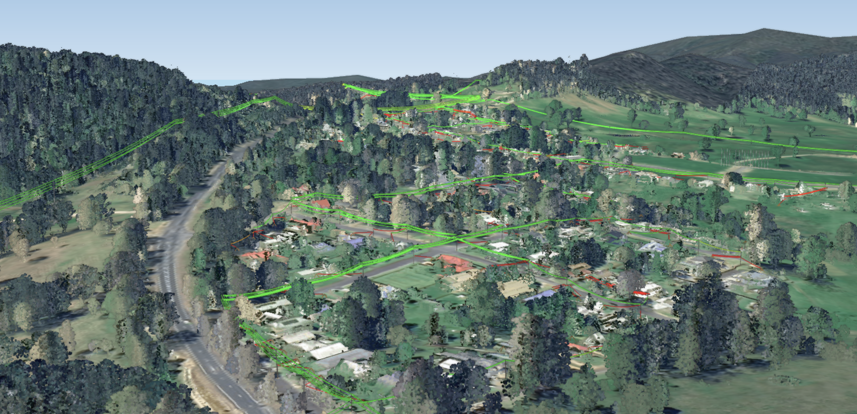
With a physics-enabled digital twin, you’re not just visualizing your network.
You’re understanding how it actually works—structurally, spatially, and dynamically.
This starts with capturing three critical relationships between assets and their surroundings, between individual assets,
and between workflows, so you can prioritize every risk through a single frame of reference. When combined, you have the full context you need to answer any 'what if' scenario and see the downstream effect of every decision on your entire network.
Answer any 'what-if' question.
Across every context and every timescale.
Where will water levels breach clearance in 3 inches of rain per hour?

How will a pole relocation impact vegetation encroachment?
Between
individual assets
If one pole fails, how many others will follow in a cascading failure?
�Enhance your data sets with physics-based insights and send more complete, accurate asset data back out.
That means every system downstream benefits from better inputs and more informed decisions.
10
9
8
7
6
5
4
3
2
1
0
X
faster
structural load analyses
2
1
0
X
more
existing network capacity
X
Get a demo
Thank you
How will a pole relocation
impact vegetation encroachment?
If one pole fails, how many others
will follow in a cascading failure?
Where will water levels breach clearance in 3 inches of rain per hour?
� assets and their surroundings

individual
assets
upstream and
downstream workflows
Between
Between
Between
0
0
0
0