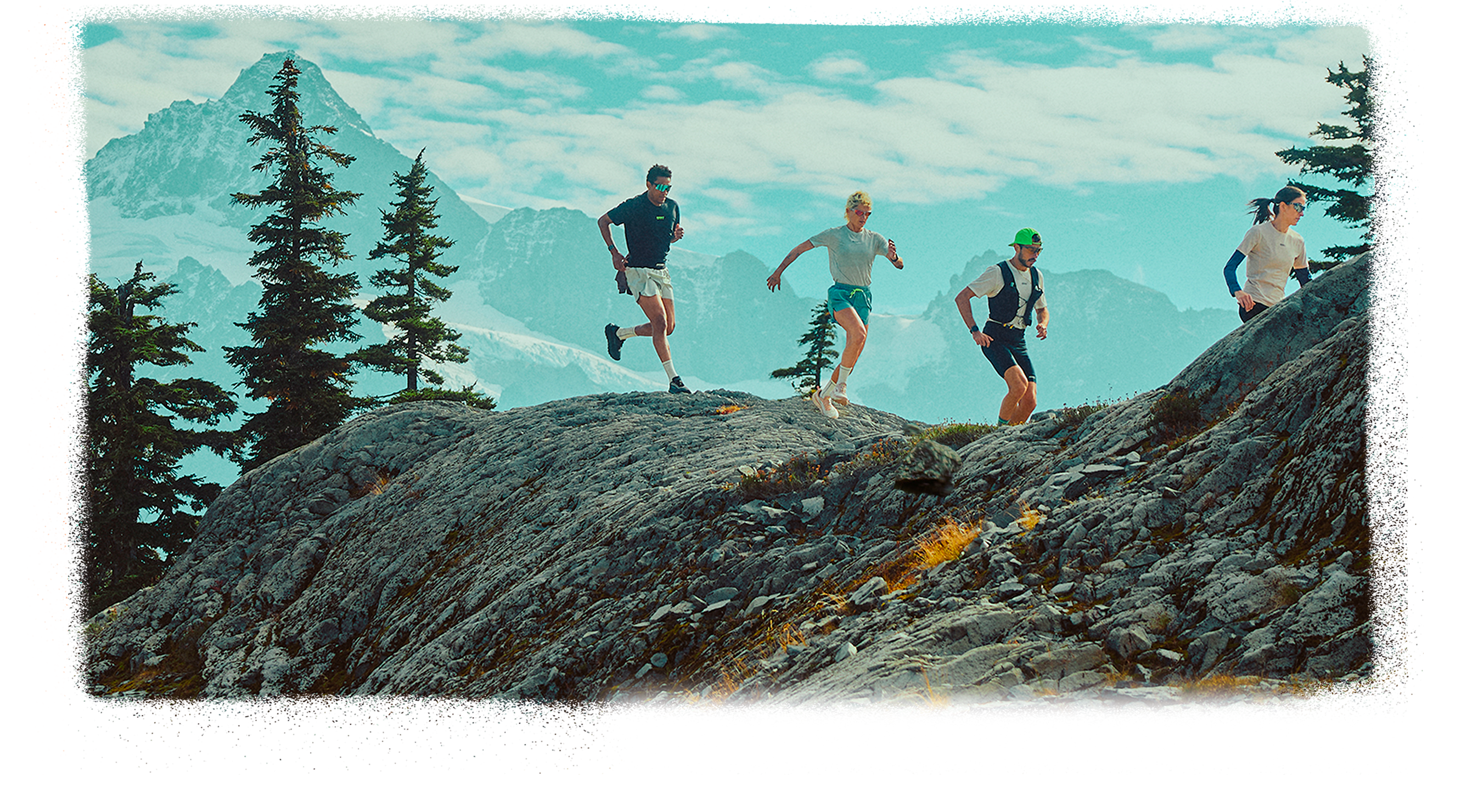
Seattle, WA
With trail running, you tap into the body-and-soul benefits of exercise in the outdoors—and those benefits are multiplied on the country’s most awe-inspiring routes. No wonder the number of trail runners is big and getting bigger. To help you get started—or take your routine to the next level—we’ve collected the best trails for every type of runner in key hot spots across the country. Add the all-terrain performance of the Brooks Cascadia Collection, and experience the force of nature wherever the trail takes you.
Experience the country’s best scenery and terrain—just start with this guide to top routes and get outfitted with the Brooks Cascadia Collection, a head-to-toe trail running kit designed for epic outings


Seattle, WA
PORTLAND, OR
BEND, OR
SAN DIEGO, CA
ARIZONA
ROCKY MOUNTAINS
BOULDER, CO
NORTH CAROLINA

ROCKY MOUNTAINS
With North America’s premier mountain range stretching 3,000 miles from Canada to New Mexico, trail runners all along its path enjoy big climbs, rocky peaks, alpine lakes, and adventures galore. The Continental Divide runs along the spine of the Rockies, making for a great backdrop wherever you run.


The Gear to Get You Out There
The Brooks Cascadia Collection builds on two decades of experience helping runners take on any trail
When Brooks launched the Cascadia trail running shoe 20 years ago, its mission was clear: Give runners all-terrain adaptability, and the confidence to take on any trail in any condition. The result is a rugged, reliable, grippy, and comfortable shoe that gets better with every iteration.
Now Brooks brings that same mission—equip trail runners to take on any trail with confidence—to the Cascadia Collection, a head-to-toe gear system designed for epic runs. From shoes to hydration vest to half tights to socks, the Cascadia Collection is like a Force of Nature no matter where you run.


Cascadia Hydration Vest
Cascadia Short/�Half Tight
Cascadia Crew Socks
Brooks Cascadia 20

A good running vest should go unnoticed. No bounce, easy access, no rubbing. That’s exactly what the Cascadia Hydration Vest does. With two 500ml HydraPak SoftFlasks (included) that sit close to the body and smart pocketing all around, the Cascadia Hydration Vest allows for self-sufficiency with a minimalist feel. A slide-through pocket at the lower back and drop-in and zippered pockets on the front allow easy on-the-go access. An adjustable bungee closure system keeps the pack comfortable and secure.
SHOP NOW
Cascadia Hydration Vest

The new women’s Cascadia Short Tights and men’s Cascadia Half Tights both feature a built-in storage belt system with two large pockets that sit close to the body and keep gear like a soft flask, fuel, and other essentials at the ready. Additional storage includes a drop-in pocket at the hip and a small, concealed zippered side pocket. The nylon/spandex fabric hugs the body for chafe-free running.
Shop Men’s
Shop Women’s
Cascadia Short/Half Tight
Socks: So important, so hard to get right. That’s why the Cascadia Crew Socks are such a game-changer. They’re made from a Coolmax yarn—a blend of nylon, polyester, and spandex—that wicks sweat to the fabric’s exterior, where it evaporates, so your feet stay cool, dry, and blister-free. Seamless toe construction, breathable mesh at the top of the foot, and a locked-in fit at the heel add to the comfort, and the crew length keeps out trail debris. With socks, as with all gear, it’s the details that count.
SHOP NOW
Cascadia �Crew Socks
Brooks Cascadia 20
PORTLAND, OR
BEND, OR
SAN DIEGO, CA
ARIZONA
ROCKY MOUNTAINs
BOULDER, CO
NORTH CAROLINA
+ THE GEAR TO �GET YOU OUT THERE


The best way to develop gear that really works? Identify athletes performing at the top of their sport and work with them to design truly innovative products—gear that advances the category and helps them reach their potential.
That’s exactly what Brooks did to launch the Cascadia in the early 2000s, when a lanky Minnesotan named Scott Jurek began dominating the Western States 100-Mile Endurance Run. The Brooks team took notice, and a years-long partnership was born, with Jurek helping Brooks designers develop a shoe that could handle the rigors of varied terrain over long miles. Jurek wore a prototype of the first Brooks Cascadia trail running shoe during his sixth Western States 100 win in 2004. And it just keeps getting better.
�
SCOTT JUREK

Let's Run There


�Traction: The shoe is equipped with a Vibram Megagrip outsole with Vibram Traction Lug technology for excellent grip on wet and dry surfaces, plus 4-millimeter multidirectional lugs that dig into soft ground and firm terrain.�Comfort: The midsole cushioning in the Cascadia 20 has been upgraded to DNA FLASH v2; it has 4mm of additional foam in the heel and forefoot compared to the Cascadia 19, for superior comfort and protection.�Stability: TrailAdapt™ Technology features a wide base of support, flexibility in critical areas, and adaptable lugs to help you move through the trail.�Durability: The engineered mesh upper features a 3D-printed overlay mudguard and a TPU toe cap to help protect against rocks and roots.
�SHOP MEN'S
SHOP WOMEN'S�
Traction, durability, versatility, comfort. The features that made the first Cascadia so effective still drive innovation in the latest one.
The best way to develop better gear? Work with elite athletes to design truly innovative products that help them reach their potential. That’s exactly what Brooks did to launch the Cascadia in the early 2000s, when a lanky Minnesotan named Scott Jurek began dominating the Western States 100-Mile Endurance Run. The Brooks team took notice, and a years-long partnership was born. Jurek wore a prototype of the first Brooks Cascadia trail running shoe during his sixth Western States 100 win in 2004. And it just keeps getting better.

Brooks Cascadia 20

SEATTLE
Water, water everywhere. That’s what makes the Seattle area so uniquely beautiful. Puget Sound, Lake Washington, and Lake Union are stunning backdrops on their own. They also bring moisture to the air. That means all shades of green—trees, giant ferns, and fuzzy moss—color the region’s rainforest and coastal paths. Add snowcapped volcanic mountains rising above it all, and you have a trail running mecca.

SAN DIEGO
The year-round sunshine and network of coastal trails alone would be enough to make San Diego a trail running paradise. Add inland hills, sage-covered canyons, and the sweet smell of eucalyptus trees, and this SoCal landmark is so much more than a beach getaway.

ARIZONA
Sedona. The Grand Canyon. Flagstaff. The Sonoran Desert. A list of Arizona’s trail running highlights reads like a life list of desert routes. From red rock to deep canyons to alpine forests, Arizona boasts a diverse array of trails and weather so it’s always perfect conditions somewhere.

Hangover Trail, Sedona
8.2 miles

Humphreys Peak, Flagstaff
9.6 miles


Rim-to-Rim-to-Rim (or Rim-to-River), Grand Canyon
40.6 miles
Humphreys Peak, Flagstaff | 9.6 miles MODERATE
Discover terrain that’s more Rockies than red rock. This run starts at Snowbowl ski resort, north of Flagstaff, and climbs 3,300 feet to the top of Humphreys Peak, the highest point in Arizona, at 12,633 feet. The 9.6-mile round-trip route climbs through aspens, breaks out above treeline, and boasts big, big, big views—making it a popular showcase among local trail runners.


Hangover Trail, Sedona | 8.2 miles EASIEST
Experience the magical red-rock scenery of Sedona on this lollipop loop. You’ll pass under a rocky overhang (or “hangover”) for a tunnel-like experience before crossing an exposed, rocky slab between two spires. Like what you see? Sedona’s network of trails makes it easy to explore far and wide.

BEND
Ponderosa pines surround Bend and infuse the local trails with a piney scent. The Deschutes River runs through the heart of town, along with a mixed surface trail that makes for a great route. Add the running-friendly climate and nearby Cascades for big-mountain terrain, and it’s no wonder Bend is widely loved.

BOULDER
If trail running has an epicenter in the Rockies, it’s this hyper-sporty town. Thanks to a surplus of challenging, scenic terrain in “foothills” that top 8,000 feet, Boulder keeps a robust community of trail runners fit and happy. From cruisey singletrack to serious steeps, here’s where to join the fun.

NORTH CAROLINA
The best trail running locations offer a variety of terrain. By that measure, North Carolina might just be the ultimate spot. From the Appalachian Mountains to coastal paths, from wide-open balds to riverside trails, and from rhododendron tunnels to rocky and rooty terrain, North Carolina has it all.

PORTLAND
Trail runners in Portland, Oregon, are blessed with dense forests, flowing rivers, and countless waterfalls. Add hills, valleys, and gorges with plenty of elevation change, Mount Hood looming above, and 5,200-acre Forest Park right in the city, and you have a trail running paradise.
Any TRAIL

Take On

Tumalo Falls Loop
7.2 miles

South Sister
11.4 miles


Three Fingered Jack
22.3 miles
Three Fingered Jack | 22.3 miles ADVANCED ��This scenic loop through raw wilderness, connecting the Pacific Crest Trail with the Old Summit Trail in the Mount Jefferson Wilderness, makes for a big (and beautiful) day. The route encircles Three Fingered Jack, a 7,840-foot volcano, with epic views of surrounding peaks and valleys.


South Sister | 11.4 miles MODERATE
The trio of volcanic summits called the Three Sisters offers a perfect test piece: steep climbing and views equal to the effort. The classic route, a hair over 11 miles (depending on where you start), tags the top of 10,358-foot South Sister. The final mile of the 5,036-foot ascent, made extra challenging by loose footing, has been dubbed “The Red Mile” by local runners.


Tumalo Falls Loop | 7.2 miles EASIEST
Oregon is deservedly famous for its waterfalls, and this one belongs on every Bend must-run itinerary. The route features multiple cascades, including 97-foot Tumalo Falls near the trailhead. The rest of the loop—along Tumalo Creek and the North Fork Trail—is equally scenic, and the mellow grade encourages speed as it meanders through a forest of pine, spruce, and hemlock.

Mesa Trail
6.4 miles

Green Mountain
4.6 miles


Boulder Skyline Traverse
16.9 miles
Boulder Skyline Traverse | 16.9 miles ADVANCED ��Here’s a rite of passage for all Boulder trail runners. This point-to-point route hits all five peaks that rise above town: South Boulder Peak, Bear Peak, Green Mountain, Flagstaff Mountain, and Mount Sanitas. With nearly 12,000 feet of elevation change, the run delivers views from every perspective, overlooking both the town to the east and the Rockies to the west. Bonus: Cool off when the route crosses Boulder Creek.


Green Mountain | 4.6 miles MODERATE
At 8,450 feet, Green Mountain is only the third-tallest peak in the Boulder foothills. But the route to the summit, with 2,351 feet of elevation gain and (mostly) runner-friendly grades, is a local favorite. Bonus: Atop a short, rocky scramble on the summit, a survey marker identifies all the Rocky Mountain peaks visible in the distance.


Messa Trail | 6.4 miles EASIEST
Want to stretch the legs on a path that’s perfect for opening things up? This one-way trail starts in historic Chautauqua Park and ends at the rock climber’s paradise of Eldorado Canyon. In between, the well-maintained trail rolls through pine forest and wildflower meadows and crosses crystalline creeks, with views of Boulder’s iconic Flatirons. Thanks to numerous trailheads, you can take on any section of the trail for a shorter sample.

Wasatch Crest Trail, Utah
12.6 miles

Longs Peak, Colorado
13.6 miles


Teton Crest Trail, Wyoming
38.4 miles
Teton Crest Trail, Wyoming | 38.4 miles ADVANCED ��The scenery-per-mile ratio of this route through Grand Teton National Park sets the bar for all other alpine runs. The park’s jagged peaks, deep-blue lakes, plentiful wildlife, and kaleidoscope of wildflowers all come together on the Teton Crest Trail. Don’t be too intimidated by the distance—for fit athletes, the point-to-point trail is a surprisingly runnable route, and the life-list experience is worth the shuttle hassle (for an out-and-back with plenty of breathtaking scenery in about half the distance, check the route from String Lake to Solitude Lake).


Longs Peak Trail, Colorado | 13.6 miles MODERATE
Yes, 14,259-foot Long’s Peak is the tallest mountain in Colorado, but that’s not why it’s such a magnet for ambitious trail runners. It’s because the challenging route delivers the perfect balance between smooth-striding singletrack and rocky, test-yourself scrambling. Caution: The last mile is an exposed, rocky scramble.


Wasatch Crest Trail, Utah | 12.6 miles EASIEST
Get a bird’s-eye view of Utah’s iconic Wasatch Mountains from the Dog Lake-Desolation Lake Crest Loop. Expect wildflowers in summer, colorful fall leaves in autumn, and sparkling lakes in every season.

Torrey Pines State Natural Reserve
3.1 miles

El Cajon Mountain
10 miles


Mission Trails Five-Peak Challenge
16.3 miles
Mission Trails Five-Peak Challenge | 16.3 miles
ADVANCED ��The precise distance of this run depends on the route you choose, but one thing doesn’t change: the epic views of ocean and peaks and valleys. The classic challenge strings together the five peaks in Mission Trails Regional Park: Cowles Mountain, Pyles Peak, Kwaay Paay, and North/South Fortuna. It’s an epic day with more than 4,000 feet of climbing. Just pack plenty of water for the dry terrain.


El Cajon Mountain | 10 miles MODERATE
Locals refer to El Cajon Mountain as El Cap—because the 3,677-foot mountain resembles Yosemite’s famous granite monolith and for its location, adjacent to the now uninhabited Capitan Grande Indian Reservation. Or you could just call it El Leg Burner: The route gains more than 3,000 feet as it scales the rugged mountain in the Cuyamaca Range, reaching a prominent summit with 360-degree views.


Torrey Pines State Natural Reserve | 3.1 miles EASIEST
Featuring a well-marked, 8-mile trail network that allows loop runs of various lengths, this coastal park is the perfect starter run in San Diego. The terrain is accessible and fun, and the colors are gorgeous: orange sandy trails, deep-green coastal sage and Torrey pines, and the vast blue of the Pacific Ocean below. A 3.1-mile loop includes the Razor Point Trail, the Beach Trail, the Broken Hill Trail, and the South Fork Trail, with short out-and-backs to Razor and Lookout Points.

Discovery Park, Seattle
4.4 miles

Tiger Mountain, Issaquah
4.5 miles


The Enchantments Thru-Run, Leavenworth
18.6 miles
The Enchantments Thru-Run, Leavenworth | 18.6 milesle
ADVANCED ��When they say the rewards are equal to the effort, they must have had this route in mind. This point-to-point epic serves up granite slabs, alpine lakes, rocky spires, creek crossings, and (often) mountain goats in the Alpine Lakes Wilderness. The run can be tackled in either direction, but the most popular—west to east—delivers a whopping 2,200 feet of climbing in a single mile up Aasgard Pass. Local shuttle services are available.


Tiger Mountain, Issaquah | 4.5 miles MODERATE
Issaquah is nicknamed “Trailhead City” for a reason. More than 60 trailheads offer a huge variety of routes, and all of them are gorgeous. Tackle Tiger Mountain for one of the best: a steep, technical run to West Tiger 3. The route zigs and zags through old-growth forest, moss-covered trees, and giant ferns, with roughly 2,000 feet of elevation gain. There’s also a longer loop (8+ miles) that adds the summits of West Tiger 1 and 2.


Discovery Park, Seattle | 4.4 miles EASIEST
Seattle’s largest urban park features roughly 12 miles of trails that wind through open meadows, forested paths, and along sea cliffs. For a taste of everything, target the 4.4-mile Discovery and Lighthouse Loop, which includes running past the picturesque West Point Lighthouse on the edge of Puget Sound.

Silver Falls State Park, Sublimity
7.3 miles

Elks-Kings Loop, Tillamook State Forest
9.8 miles


Timberline Trail, Mount Hood
39.5 miles
Timberline Trail, Mount Hood | 39.5 miles ADVANCED ��Every ambitious trail runner should target this iconic route. Circumnavigating 11,249-foot Mount Hood, the highest point in Oregon, the Timberline Trail cruises through wildflower-rich meadows, high-alpine terrain, river crossings, and shady forests. And, of course, it offers countless views of Mount Hood. Most runners start and end at the historic Timberline Lodge.


Elks-Kings Loop, Tillamook State Forest | 9.8 miles
MODERATE
Ready to test yourself and your gear? This rugged, rocky route tags both Elk Mountain and King Mountain, traversing exposed ridges and delivering big views of the Pacific Ocean and the surrounding peaks of the Cascades. With a total elevation gain of 3,600 feet, this run makes for a memorable day that’s equal parts stunning and challenging.


Silver Falls State Park, Sublimity | 7.3 miles EASIEST
If you live in Portland, you will log plenty of miles in Forest Park, where a network of trails sits in the heart of the city. But venture just a short distance out of town, and you can experience one of the country’s best runs when it comes to mile-for-mile beauty. The Trail of Ten Falls winds through a stunning old-growth forest and passes 10 waterfalls, one 177-feet high, and four that you can view from behind their cascades.
Roan Highlands, Bakersville
5.5 miles

Black Mountain Crest Trail, Burnsville
7.4 miles


Art Loeb Trail, Canton/
Davidson
29.4 miles
Art Loeb Trail, Canton/Davidson | 29.4 miles ADVANCED ��Put all of North Carolina’s forest highlights together on the Art Loeb Trail, affectionately known as one of the toughest trails in the East. The route climbs more than 8,000 feet, descends nearly as much, and traverses wildflower-filled ridgelines and travels up and over big-view balds in the Pisgah National Forest. It’s such an iconic one-way route that local shuttle services have sprung up, making logistics easy.


Black Mountain Crest Trail, Burnsville | 7.4 miles MODERATE
For runners east of the Mississippi, the Black Mountain Crest Trail counts as a must-do high-elevation route. For a 7.4-mile out-and-back, start at Mount Mitchell State Park (on the park’s namesake 6,684-foot peak) and run to Deep Gap campground. You’ll cross over five peaks en route, including the second highest peak east of the Mississippi (Mount Craig), but the first half of this run descends more than 1,000 feet on rocky, rooty terrain before climbing back up.


Roan Highlands, Bakersville | 5.5 miles EASIEST
If you haven’t experienced a “grassy bald” in prime time, you’re in for a treat. These uniquely Appalachian summits, with 360-degree views and lush growth, and plenty of space to spread out for a mid-run picnic, are especially beautiful in spring and summer. See what all the fuss is about on this out-and-back on the Appalachian Trail, from Carvers Gap to Grassy Ridge.


Rim-to-Rim-to-Rim (or Rim-to-River), Grand Canyon | 40.6 miles
ADVANCED When it comes to big-adventure trail runs, nothing compares to crossing the Grand Canyon. There’s also nothing harder, so get fit and get equipped. From the South Rim, you plunge to the Colorado River on the South Kaibab Trail, ascend to the North Rim on the North Kaibab Trail, and reverse course. The payoff: the run of a lifetime.


High Point Short Sleeve 2.0
A good running shirt is quick-drying and durable. A great running shirt is also ultra comfortable. TThe High Point Short Sleeve 2.0 nails it all, with technical fabric (91% recycled polyester and 9% spandex), a semi-fit design that’s tuned for performance as well as layering, and longer sleeves that help reduce chafing. Add an antimicrobial treatment for built-in odor resistance and reflective branding on both the front and back, you have the perfect shirt for demanding conditions.
SHOP MEN'S
SHOP WOMEN'S
High Point Short Sleeve 2.0