#1 Badlands and Battlefields
#2 Prairie to Peak
#3 Dark Skies and Wildlife
#4 River Country Roamer


A Whole New Side of Adventure
Road trip itineraries to explore the lesser-known regions of Montana
Presents


CLICK TO HEAR SOUNDS OF THE River


Tower Rock State Park
Helena
Sluice Boxes
State Park
Lewistown
White Sulphur Springs
Augusta
Central Montana
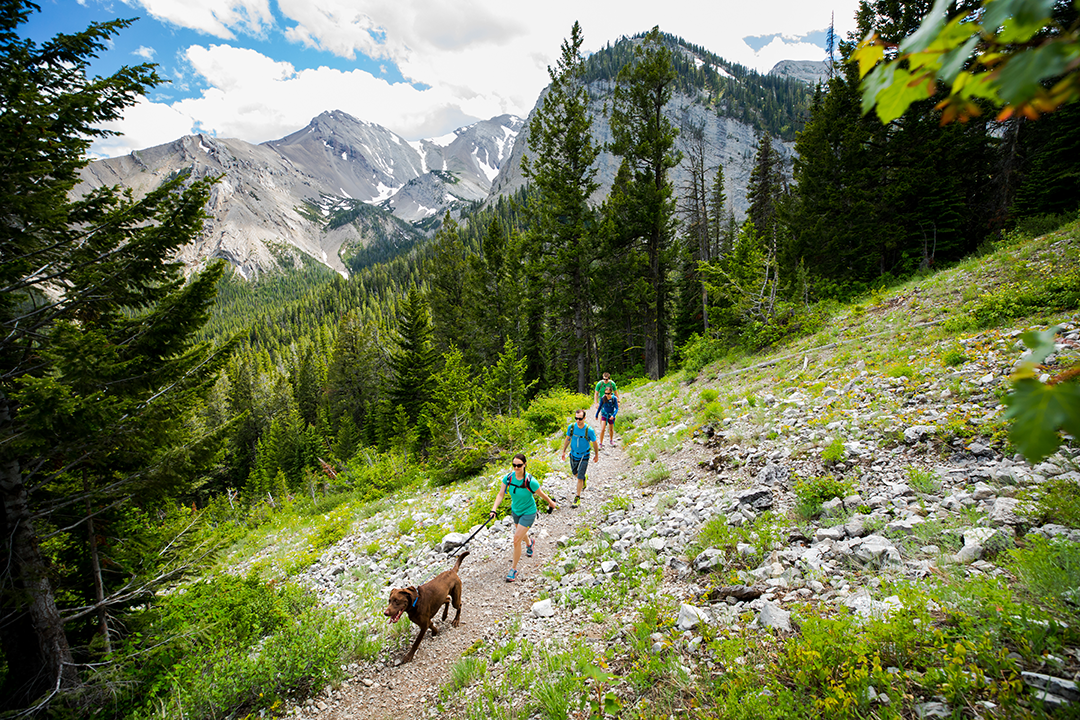
Situated between Glacier and Yellowstone national parks, Central Montana is truly the heart of Big Sky Country. The region’s varied landscapes—from plains to high mountains—provide the perfect setting for outdoor adventures.
Distance: 427 miles // Time: 3 days
Helena to Tower Rock State Park (Interstate 15) to Augusta & Sluice Boxes State Park (Interstate 15 and U.S.287) to Lewistown (U.S. 87) to White Sulphur Springs (U.S. 191 and U.S. 12) // MAP THE ROUTE
Make a Splash in Fort Peck
Fort Peck Lake is like an ocean in the middle of Montana with an abundance of coastline and secluded coves to fish, waterski, paddle, or just explore.


CLICK TO HEAR SOUNDS OF THE TRAIL

Three Forks
Little Bighorn Battlefield National Monument
Bighorn Canyon National Recreation Area
White Sulphur
Springs
West to East
Venture into the wide open spaces of Central and Eastern Montana. Beneath this region’s unending skies, you’ll find ample room to roam and connect with nature.
Distance: 521 miles // Time: 4 days
Three Forks to Townsend (U.S. 287) to White Sulphur Springs and Roundup (U.S. 12)
to Bighorn Canyon National Recreation Area (U.S. 87 and 310) to Pryor (U.S. 310) to
(Interstate 90) to Crow Agency (Montana 313) // MAP THE ROUTE
Visit Pompeys Pillar and Little Bighorn Battlefield
Take a tour of these two national monuments in Eastern Montana and get a taste of western history.
Explore the Best of Billings, Montana
Situated on the banks of the Yellowstone River, Montana’s most populous city is also a cultural and economic hub.


Lewistown
Fort Peck Lake
Malta
Hell Creek
Recreation Area
Eastern Montana
Enjoy maximum adventure and scenery on this five-day trip, exploring glaciated mountains, broad rivers, and small towns filled with charm and rich history.
Distance: 687 miles // Time: 5 days
Lewistown to Zortman (U.S. 191) to Havre (Montana 66 to U.S. 2) to Malta and Fort Peck (U.S. 2)
to Hell Creek Recreation Area (Montana 24 and 200) to Miles City (Montana 200 and 59) to Makoshika State Park (Interstate 94 and Montana ) // MAP THE ROUTE
Click to Listen to Sounds of the Prairie

CLICK TO HEAR SOUNDS OF nightfall

Glacier National Park
Swan Mountain
Llama Trekking
Libby
Cedars
Area
Ferndale
Garnet
Ghost Town
Northwest Montana
From wildflower-filled meadows to snow-fed streams, Northwest Montana—or Glacier Country—is one of those places you have to see to believe. Explore the best of the region on a four-day, adventure-filled road trip.
Distance: 414 miles // Time: 4 days
Libby to Big Fork (U.S. 2 to Montana 82) to Seeley Lake (Montana 83) to Lincoln (Montana 83 to Montana 209) to Augusta and Choteau (Montana 200 to U.S. 287) to East Glacier Park, Browning, and the Blackfeet Nation (U.S. 89) // MAP THE ROUTE
Watch now!

Gaze Beyond in Medicine Rocks State Park
Now entering a designated Dark Sky Sanctuary (aka a stargazing haven ).

Back up to map
East Glacier Park
Lincoln
Ferndale
Libby
Back up to map
Lewistown & White Sulphur Springs
Augusta &
Sluice Boxes State Park
Helena & Tower Rock State Park
Back up to map
Hardin & Little Bighorn Battlefield National Monument
Bighorn Canyon National Recreation Area
Three Forks
Makoshika State Park
Makoshika State Park
Fort Peck & Hell Creek Recreation Area
Havre & Malta
Lewistown & Zortman
Hardin & Little Bighorn Battlefield National Monument
03/03
In Hardin and the surrounding area, explore the region’s rich heritage. Visit Big Horn County Historical Museum to see 24 meticulously preserved historic structures, including a Crow tipi and building dating back to 1915. Then take a guided tour of the Little Bighorn Battlefield National Monument with Apsáalooke Tours to more fully appreciate how conflict between Indigenous tribes and U.S. expansion shaped Montana.
Little Bighorn Battlefield National Monument will have limited visiting hours and access starting in spring 2024 as a new, state-of-the-art visitor center is built. On days when the monument is closed, the Big Horn County Historical Museum will be staffed with rangers who can answer visitors’ questions about the site. Visit the National Park Service website for the most up-to-date operating hours and information.
Note:


Bighorn Canyon National Recreation Area
Get out for a paddle on Canyon Ferry Reservoir or stop in White Sulphur Springs for a dip in a natural hot spring. Jesse Pepper’s Smoke Stack or The Jawbone are great options for lunch in town before you head to Bighorn Canyon National Recreation Area for a day of boating on the lake. Rent a boat or take a guided, on-the-water wildlife tour of Bighorn Canyon or Yellowtail Dam with a local outfitter. Cap off your day with dinner at 3 Brothers Bistro.

02/03
Three Forks
With Three Forks as your basecamp, grab your hiking boots and explore nearby Missouri Headwaters and Madison Buffalo Jump state parks, where trails wind through stunning prairie landscapes. If you packed your fishing rod, cast a line at Blackbird Fishing Access Site, where rainbows, browns, cutties, whitefish, and more are usually biting.


01/03
East Glacier Park
Of course no visit to the region would be complete without a stop in East Glacier Park to access more than a thousand miles of hiking trails with views of glaciers and snow-capped peaks in Glacier National Park. Then visit the Blackfeet Nation—home to the largest Native American tribe in Montana—to learn more about the Nation’s traditions and culture at the Museum of the Plains Indian and to shop for artisan goods at the Faught's Blackfeet Trading Post.

04/04
Lincoln
En route to Lincoln, stop by Garnet Ghost Town, the best-preserved mining town in the state, which was home to approximately 1,000 residents in its heyday in 1898. Wander down the historic town's Main Street to explore the remains of a saloon, hotel, general store, and post office. In Lincoln, immerse yourself in the captivating public art of Blackfoot Pathways: Sculpture in the Wild. And don't miss the chance to see one of Montana's largest grizzly bears on record—now a taxidermy display at the Lincoln Ranger District Visitor Center.

03/04
Ferndale
From there, Ferndale is your gateway to world-class hiking in the Jewel Basin. Or for a truly unique experience, book a llama trekking adventure with Swan Mountain Llama Trekking.
02/04
Libby
Kick off the trip in Libby, at the edge of the Kootenai National Forest in the foothills of the Cabinet Mountains. Walk across the Kootenai Falls Swinging Bridge. Then hike among 1,000-year-old cedar trees that grow up to 8 feet in diameter at Ross Creek Cedar Grove Scenic Area.

01/04
Lewistown & White Sulphur Springs
Don’t miss a chance to stop in Lewistown, where you can learn more about the region’s heritage at the Central Montana Historical Museum, which exhibits a collection of homesteader artifacts and highlights local legends, including Western artist and former area resident Charles M. Russell and saddle maker Tom Toomey. Cap off the trip with a soak in the hot springs in White Sulphur Springs before grabbing dinner at Bar 47 in town.

03/03
Augusta & Sluice Boxes State Park
Set up basecamp in Augusta, one of many quaint towns in the region, to access the Bob Marshall Wilderness for hiking, fishing, and horseback riding. Day trip to Choteau to explore the Flathead National Forest and hike the 1.5-mile Elk Calf Trail, with views of Glacier National Park. Then make your way to Sluice Boxes State Park to hike along the steep cliffs and rugged terrain of Belt Creek Canyon. One warm summer days, a dip in Belt Creek is the perfect way to cool off after a morning of hiking.


02/03
Length of Peck’s Rex skeleton
Helena & Tower Rock State Park
01/03
Start your trip in Helena, Montana’s capital city, where rugged mountains blend seamlessly with the town’s modern charm and you can enjoy everything from art museums to mountain bike trails to delicious local eats. From there, hit the road en route to adventure. Explore nearby Tower Rock State Park to see the 424-foot-high rock formation that holds significance for Native American tribes and was noted by Capt. Meriwether Lewis in his expedition journals.


Makoshika State Park
Cap off the trip at Makoshika State Park, Montana's largest state park, known for its badlands formations, including caprocks, land bridges and fossils. Plan your visit to stay in the park after the sun goes down so you can join in on the ranger-led Night Sky programs to learn about our galaxy while you view the starry sky with minimal light pollution.


04/04
Fort Peck & Hell Creek Recreation Area
Spend a day recreating on Fort Peck Lake. This massive 245,000-acre reservoir is the largest man-made lake in the state and the fifth largest in the country. Rent a boat at one of the marinas then cast a line for a chance to land Chinook salmon, whitefish, smallmouth bass, and more. Or hike along the lake’s rugged shoreline—part of Hell Creek Recreation Area.

03/04
Havre & Malta
02/04
Experience Central Montana's small-town charm with a stop in Havre. This historic, artsy spot is filled with unique shops and restaurants. Visit the nearby Wahkpa Chu'gn Buffalo Jump, an important part of Indigenous history. See the remains of a bison corral structure incorporating bison skulls and a roasting pit with bone depths of up to 20 feet. Then continue on to Malta to explore the Montana Dinosaur Trail and get a closer look at the region’s natural history.


Lewistown & Zortman
Start in Lewistown—the geographical center of the sate—where you'll be able to access the best of Central Montana's outdoor adventures. Bike along 24 miles of trails through the city’s vibrant downtown, and stop off at Montana Tavern for drinks and a night of bar games. Head 30 minutes north through the Little Rocky Mountains to Zortman, which was once a booming mining town in the 1880s. Although the mines are long since closed, visitors can still pan for gold in the creeks around town. Stop by Lookout Cave to see the largest collection of preserved pictographs in the state.


01/04

Montana is one of those places with boundless outdoor adventure cred. Its high glaciated mountains, broad rivers, welcoming small towns, and rich history have earned it a rightful spot atop the bucket lists of travelers from around the globe. As its nickname implies, Big Sky Country is as vast as it is astounding, and its best-known gems like Glacier and Yellowstone national parks are just the beginning when it comes to outdoor adventure.
In fact, visitors who venture eastward—into rugged badlands, meandering rivers, secluded mountain ranges, and vast prairie—will be rewarded with an unexpected and wholly different kind of Montana experience. The opportunities to fish, hunt, hike, ride, eat, and learn are practically endless. Not sure where to start? Follow one (or all!) of these road trip routes to discover a new side of adventure in Eastern Montana.


Lewiston
Upper Missouri River Breaks
Lewis and Clark Hut
Crystal Lake
Zortman
Prairie to Peak Adventure Route
Lorem ipsum dolor sit amet, consectetur adipiscing elit. Sed nec facilisis elit. Ut ultrices mauris ac dui tristique tincidunt. Pellentesque at tortor in quam mattis pharetra sed at sapien. Mauris pellentesque elementum orci, ac dictum felis viverra nec. Pellentesque habitant morbi tristique senectus et netus et malesuada fames ac turpis egestas. Fusce vitae ipsum nec neque ultrices lobortis. Sed quis aliquet enim, eu volutpat odio. Donec in sollicitudin erat, sit amet aliquam leo. Sed et congue orci, ac hendrerit sapien. Ut dolor nibh, sagittis vel finibus vel, eleifend at libero. Aliquam rhoncus gravida laoreet. Nulla hendrerit eu elit eget ullamcorper. Nullam eget dui nec justo lacinia facilisis. Integer nec auctor elit. Etiam neque velit, pellentesque.
Distance: 335 miles // Time: 3–5 days
Lewistown to Upper Missouri River Breaks (U.S. 191) to Zortman (Ervine Ridge Road to Montana 66 to U.S. 191) to Crystal Lake (U.S. 191)
#1 Badlands and Battlefields
#2 Prairie to Peak
#3 Dark Skies and Wildlife
#4 River Country Roamer
Four Road Trip Itineraries


CLICK TO HEAR SOUNDS OF THE River

Glasgow
Rock Creek Recreation Area
Medicine Lake National Wildlife Refuge
Sidney
Brush Lake State Park
Scobey
River Country Roamer
Northeast Montana is a place where vast expanses of prairie are punctuated by badlands, river breaks, and welcoming small towns. Two mighty waterways—the Yellowstone and the Missouri—course through the region, offering boundless opportunities for recreation, relaxation, and historical immersion.
Distance: 335 miles // Time: 3–5 days
Glasgow to Rock Creek Marina (Montana 24) to Scobey (Montana 24 to Hwy 248) to Brush Lake State Park and Medicine Lake National Wildlife Refuge (Montana 5) to Sidney (Montana 16) // MAP THE ROUTE
Watch now!


Make a Splash in Fort Peck
Fort Peck Lake is like an ocean in the middle of Montana with an abundance of coastline and secluded coves to fish, water-ski, paddle, or just explore.


CLICK TO HEAR SOUNDS OF THE TRAIL

Billings
Broadus
Ekalaka
Miles City
Glendive
Terry
Pompeys Pillar
Little Bighorn Battlefeld National Monument
Medicine Rocks State Park
Makoshika State Park
Badlands and Battlefields
A trip through Southeast Montana is like traveling through history. Here, wide-open roads transport you from Billings, a thriving modern city, to as far back in time as you want to go—from old western cattle-trading towns to Native American battlefields to otherworldly landscapes where dinosaurs once roamed. Along the way, opportunities for adventure and cultural immersion abound.
Distance: 500 miles // Time: 4–5 days
Billings to Pompeys Pillar (I-90 to Fly Creek Road) to Little Bighorn Battlefield National Monument (I-90 to U.S. 212) to Broadus (U.S. 212) to Ekalaka (U.S. 212 to State Hwy 323) to Medicine Rocks State Park (Montana 7) to Miles City (Montana 7 to U.S. 12) to Terry (I-94) to Glendive and Makoshika State Park (I-94) // MAP THE ROUTE
Watch now!


Visit Pompeys Pillar and Little Bighorn Battlefield
Take a tour of these two national monuments in Eastern Montana and get a taste of western history.
Explore the Best of Billings, Montana
Situated on the banks of the Yellowstone River, Montana’s most populous city is also a cultural and economic hub.

Lewistown
Upper Missouri River Breaks
Lewis and Clark Hut
Crystal Lake
Zortman
Prairie to Peak Adventure Route
Montana is synonymous with mountains. But the state’s topographic prominence is overwhelmingly concentrated in its western half. To the east, vast expanses of prairie unfurl to the horizon. There are pockets of Eastern Montana, though, where the Great Plains thrust dramatically upward into rugged island ranges, so named for their geographic isolation, far from the continental backbone to the west. These mountainous clusters—including the Judith Mountains, the Little Rockies, and the Snowy Mountains—offer much of what the state’s western peaks are revered for, with an added dose of solitude. The best part? The surrounding prairie and river country are every bit as impressive—and this road trip takes you through all of it.
Distance: 335 miles // Time: 3–5 days
Lewistown to Upper Missouri River Breaks (U.S. 191) to Zortman (Ervine Ridge Road to Montana 66 to U.S. 191) to Crystal Lake (U.S. 191) // MAP THE ROUTE

Click to Listen to Sounds of the Prairie
Watch now!


The Upper Missouri River Breaks National Monument
Paddling may be the main draw of the Upper Missouri River Breaks National Monument, but it’s far from the only way to explore there.


CLICK TO HEAR SOUNDS OF nightfall

Sleeping Buffalo Resort
Bowdoin National Wildlife Refuge
Malta
CMR National Wildlife Refuge
Hell Creek Recreation Area
Miles City
Baker
Medicine Rocks State Park
Dark Skies and Wildlife
Studies have linked the feeling of awe with myriad psychological and physiological benefits, and nothing is more awesome than the natural world. So it’s no wonder that a trip through Eastern Montana—where the night sky is impossibly dark, offering some of the best stargazing in the country, and where megafauna like bison and elk roam immense landscapes—can leave you feeling changed. That’s what this trip is all about. Slow down and revel in the sense of wonder as you traverse some of the state’s most breathtaking country, experiencing a secluded dark-sky sanctuary and vast wildlife refuges along the way.
Distance: 564 miles // Time: 3–5 days
Medicine Rocks State Park to Baker (Montana 7) to Miles City (U.S. 12) to Hell Creek Recreation Area (Montana 59 to Hell Creek Road) to Charles M. Russell National Wildlife Refuge (Montana 200 to Montana 19 to U.S. 191) to Malta (U.S. 191) to Bowdoin National Wildlife Refuge (U.S. 2) to Sleeping Buffalo Hot Springs (U.S. 2) // MAP THE ROUTE
Watch now!


Gaze Beyond in Medicine Rocks State Park
Now entering a designated Dark Sky Sanctuary (aka a stargazing haven ).
Back up to map
Bowdoin National Wildlife Refuge
Charles M. Russell National Wildlife Refuge
Hell Creek Recreation Area
Medicine Rocks to HellCreek Recreation Area
Medicine Rocks State Park
Back up to map
Sidney
Medicine Lake National Wildlife Refuge
Brush Lake State Park
Scobey
Fort Peck and Fort Peck Lake
Glasgow
Back up to map
Makoshika State Park and Glendive
Terry
Miles City
Medicine Rocks State Park
Pompeys Pillar and Little Bighorn Battlefield
Billings
Back up to map
Crystal Lake
Zortman
Lewis and Clark Hut
Upper Missouri River Breaks
Lewistown
Makoshika State Park and Glendive
Makoshika (pronounced Ma-ko’-shi-ka), Montana’s largest state park, often flies under the radar. But one visit is all it takes to see why the park is regarded as a crown jewel of Eastern Montana. Here, a landscape of otherworldly badlands and rugged coulees can be explored by foot, wheel, or hoof on an extensive trail system. Hike or run the rolling Hungry Joe Trail to a scenic overlook above Makoshika and Glendive (2.5 miles one way) before exploring the stunning Cap Rock Trail (0.5 mile round-trip), which leads to a natural bridge and past many of the park’s iconic toadstool-shaped hoodoos. Kids, families, and dinophiles alike might find it difficult to venture past the park’s visitor center, which is loaded with educational interpretive exhibits and prehistoric fossils, including a complete triceratops skull. And that’s just the start—the park also offers camping, disc golf, and an archery range on site.
Looking for even more local history? Back in Glendive, head to the Frontier Gateway Museum and stroll along a replica of 1800s Merrill Street, Glendive’s “Main Street.” On modern-day Merrill, pop into Hell Creek Music and More, a quirky shop that’s part instrument emporium, part music museum (multiple guitars autographed by Kiss band members are on display), and part dinosaur exhibit—a 38-foot-long replica of a T. rex skeleton looms above the registers.
At Bloom and Vine, a specialty coffeehouse, café, and wine bar, order an agave wine margarita and a fresh salad, then make a beeline for the establishment’s inviting courtyard.
Eat & Stay:

06/06
10
Ten different dinosaur species have been discovered in Makoshika State Park.
Terry

Follow Interstate 94 and the Yellowstone River 40 miles northeast to Terry, where iconic badlands dominate the town’s northern horizon. Hop on your gravel or mountain bike and ride six miles of empty two-track to the Terry Badlands Overlook, where you can watch the sunset from atop the sand castle–like cliffs. Or, if you have a high-clearance four-by-four, venture into the badlands on the Calypso Trail (impassable during periods of wet weather). Back in town, thumb your way through the extensive and eclectic book collection in the bookstore at the historic Kempton Hotel, Montana’s oldest continuously operating hotel.
05/06

Pay a visit to the Montana Bar, the historic saloon attached to Tubb’s Pub on Main Street and a stop along the Southeast Montana Burger Trail, and order a stuffed burger: the toppings and cheese are built right into the Grade A beef patty. Afterward, grab an award-winning beer at pinball-themed Tilt Würks Brewhouse or a glass of wine at Tongue River Winery.
Eat & Drink:
Miles City
Miles City is the ideal image of a western town. It’s a community rooted in the livestock industry, where weekly cattle auctions continue today. (Non-bidding visitors are welcome to drop in.) It’s a place where you can have a pair of cowboy boots or a saddle custom made to your specifications. On Main Street, experience that legacy of leatherworking for yourself—head upstairs at Miles City Saddlery to view the store’s centuries-old collection of saddles, or pop into Moran’s Custom Leather to see where custom saddles and boots are still made today.

04/06
Medicine Rocks State Park
03/06
On your way from Billings to Ekalaka, stop for a slice or a sandwich at Seabeck Pizza and Subs in Broadus. In Ekalaka, just 20 minutes south of Medicine Rocks State Park, grab a bite at Wagon Wheel Cafe, and stay at the Midway Motel or Guest House Motel.
Eat & Stay:

Pompeys Pillar and Little Bighorn Battlefield
Just 30 minutes east of Billings is one of Montana’s most historically significant points: Pompeys Pillar National Monument. This 120-foot-tall sandstone tower, now a protected national monument, bears the markings of the Indigenous peoples who utilized it as an observation point and ritual site for the past 11,000 years and to whom it remains an important spiritual site today. On July 25, 1806, William Clark and his team stopped here during their Yellowstone River exploration. Clark inscribed the pillar with his name—the carving, still visible today, is believed to be the last remaining physical evidence from the Lewis and Clark Expedition. The natural monolith, which Clark is said to have named for Sacagawea’s son, whose nickname was “Pomp,” is known to the Apsáalooke (Crow) people as "Iishiia Anaache" or "Place Where the Mountain Lion Dwells."
A short drive south of Pompeys Pillar is Little Bighorn Battlefield National Monument, another site that tells the complicated history of America’s western expansion and displacement of Indigenous peoples. The monument commemorates the infamous battle in which warriors from multiple northern plains tribes defeated the U.S. Army’s 7th Regiment of the Cavalry—known today as the Battle of Little Bighorn. During your visit, t[CEROS OBJECT]ry to catch one of two ranger-led historical presentations (these talks are unscheduled but typically take place midmorning and midafternoon) before visiting the park’s two main memorials: the Indian Memorial and the 7th Cavalry Memorial. For the most immersive experience, book a guided tour in advance through Apsáalooke Tours (available Memorial Day through Labor Day).

02/06
June 25, 1876
The Battle of the Little Bighorn began on June 25, 1876.
Billings
Situated on the banks of the Yellowstone River, Montana’s most populous city is also its cultural and economic hub. Translation: it’s the ultimate place to start, end, or spend an entire Southeast Montana getaway. Find your bearings with a hike or mountain bike ride along Billings’s iconic Rimrocks—sandstone cliffs that rise hundreds of feet above the city—starting from Zimmerman Park. Because the trailhead is located on top of the Rimrocks, visitors will find the views of five nearby mountain ranges, the Yellowstone River Valley, and downtown Billings as easy to come by as they are stunning—especially at sunrise or sunset.
Nearby, at Pictograph Cave State Park (open daily in summer; Wednesday–Sunday in winter), follow the three-quarter-mile-long interpretive trail past three caves adorned with more than 100 pieces of the park’s namesake artwork, the oldest of which dates back more than 2,000 years. Come prepared with binoculars for the best look at these ancient artworks, which are believed to have been created by nomadic hunters.
Back in downtown Billings, steep yourself in the town’s unique blend of Old West and modern cultures. When it opened in 1964, the Yellowstone Art Museum (YAM) was the first museum in the region to focus its collections on contemporary art. That tradition continues today, with an extensive permanent collection and rotating exhibitions by contemporary artists from the American Northwest and Northern Rockies. For the most immersive experience, book a guided group tour led by one of YAM’s docents (60 minutes, from $5). And don’t miss the Visible Vault, an innovative detached facility where visitors can admire YAM’s permanent collection.
Start your day with a chorizo burrito and coffee at Rail Line Coffee. Later, order a thirst-quenching Staycation IPA and catch some live music at Thirsty Street Brewing Company @ the Garage (a stop along the Billings Brew Trail). For a taste of what’s in season, pop into Walkers Grill, which features locally sourced ingredients with a focus on freshness. Bed down at the recently restored Northern Hotel, which has been offering Billings visitors a healthy dose of “unpretentious luxury” since 1904.
Eat, Drink, & Stay:


01/06
7,300
The number of pieces in the collection at Yellowstone Art Museum
Bowdoin National Wildlife Refuge
05/05
If your timing was right at C.M. Russell, you will by now have spied some charismatic megafauna. At Bowdoin National Wildlife Refuge, birds are the name of the game—hundreds of avian species flock to the refuge’s wetlands and lake, once an oxbow of the Missouri River during the pre-glacial period. In spring, catch the northbound migration of Canada geese and mallards. During summer months, grassland songbirds fill the air with musical calls as they establish mating territories. Come fall, sandhill cranes can be spotted as they fly south for winter.
On your way from James Kipp, grab breakfast at Crossroads Coffee & Bistro in Malta. If you have time, check out one or both of the town’s Montana Dinosaur Trail facilities: the Great Plains Dinosaur Museum and Field Station and Phillips County Museum. After exploring Bowdoin, head to Sleeping Buffalo Hot Springs to unwind. Spend the night in a cabin or suite on-site, or head back to Malta to stay at the Great Northern Hotel.
Eat & Stay:


1936
The year Bowdoin National Wildlife Refuge was established.
Charles M. Russell National Wildlife Refuge
It’s hard to grasp the sheer size of the C.M. Russell National Wildlife Refuge, which protects more than a million acres of critical animal habitat surrounding the Missouri River and Fort Peck Lake. Snag a campsite at James Kipp Recreation Area, then head across the river to the Slippery Ann Wildlife Viewing Area an hour before sunset. (From Highway 191, follow the CMR Auto Tour Route for 3.5 miles.) Herds of elk come here each year in late August and early September during the rut (mating season), and the spectacle is unlike anything else on Earth. Find a turnout, set up your camp chairs, and enjoy. Remember to keep at least 75 feet between you and the elk, and never approach wildlife. In the morning, consider completing the Auto Tour Route (19 miles total) en route to Malta.


04/05
#2
The Charles M. Russell National Wildlife Refuge is the second largest national wildlife refuge in the lower 48 states.
Hell Creek Recreation Area
If you look at a dark-sky map of Montana, the shading around Hell Creek Recreation Area indicates excellent conditions for stargazing. That’s because it’s a long way from pretty much everywhere—Jordan, the closest town, 25 miles to the south, has a population of less than 500. And just like at Medicine Rocks, jaw-dropping views of the Milky Way’s galactic center are just one part of the experience at Hell Creek. The recreation area campground and boat launch are located on the scenic south shore of Fort Peck Lake, an immense reservoir of the Missouri River, and are managed by the Little Shell Tribe of Chippewa Indians. Launch a canoe, kayak, or SUP to explore the many secluded coves nearby. Or link up with a local fishing guide for an excursion on the lake in search of walleye, lake trout, Chinook salmon, or northern pike, depending on the season. Pick up bait, tackle, a fishing license, and camp essentials at the marina’s general store. Reserve your campsite in advance; both RV and tent sites are available.

03/05
Medicine Rocks to Hell Creek Recreation Area
The drive to Hell Creek Recreation Area, your next stop, takes you through some of Southeast Montana’s most scenic country and coolest small towns. Your first stop is Baker, just 30 minutes north of Medicine Rocks. Stretch your legs on the paved path at the south end of Baker Lake before popping into the Coffeehouse at Lawler’s for an espresso drink and a pastry.
En route to Miles City, 80 miles west, keep your eyes peeled for pronghorn antelope as you traverse rolling agricultural land, wooded hill country, and sculpted badlands. In town, swing by the Range Riders Museum for a trip into Miles City’s western heritage. Resupply before heading north toward Hell Creek Recreation Area.


02/05
Medicine Rocks State Park
In 2020, the DarkSky International designated this 330-acre state park in Southeast Montana a
Dark Sky Sanctuary, defined as “the most remote (and often darkest) places in the world whose conservation state is most fragile.” Translation: Medicine Rocks State Park is a stargazing haven. The best way to experience the park’s superb night skies is to snag one of its 12 first-come, first-serve primitive campsites on a clear, moonless night. Better yet, time your visit to coincide with a free dark-sky event at the park. Organized by the Carter County Museum, in nearby Ekalaka, these gatherings are great opportunities to learn about astronomy and the region’s natural and cultural history and to connect with the local community.
The allure of Medicine Rocks State Park isn’t limited to the hours between sunset and sunrise—the park’s iconic rock formations are a marvel to behold during daylight hours, too, so allow enough time during your visit for a hike, ride, or run. (See Badlands and Battlefields trip, below, for more.)
Before heading out for a night of stargazing, grab a bite at one of three Southeast Montana Burger Trail stops in Baker: Heiser’s Bar & Casino, Corner Bar, and Big Game Casino Tavern & Steakhouse.
Eat & Stay:

01/05
3
Number of certified Dark Sky Sanctuaries in the state of Montana.
Sidney
Sidney, “The Sunrise City,” gets its nickname from its location at the far eastern edge of the state—it’s the first place in Montana to see the sun each day. On your way through, cast for warm-water species or search for birds along the Yellowstone River, browse the Mondak Heritage Center for more early-1900s western history, or pop into Meadowlark Brewing and Public House for a Badlands India Pale Ale and a burger.

06/06
Medicine Lake National Wildlife Refuge
Just south of Brush Lake is another water feature worth a visit: Medicine Lake National Wildlife Refuge. The lake at the center of the refuge was created by the Missouri River, which flowed through the area before the last ice age. Today it’s a haven for hundreds of species of migratory birds, including American white pelicans and great blue herons, as well as land mammals like pronghorn antelope and white-tailed deer.

05/06
100,000
Medicine Lake National Wildlife Refuge sees more than 100,000 migratory waterfowl annually.
Brush Lake State Park
In the far northeastern corner of Montana—just a stone’s throw from both North Dakota and Canada—Brush Lake State Park is an oasis on the prairie. Here, the lake is the main attraction. Its deep, clear waters offer the antidote to summer heat. Utilize the park’s boat ramp to launch a kayak, SUP, or ski boat and explore the roughly mile-long lake. The lake’s relatively high alkalinity gives it an almost ocean-like appearance, with aquamarine hues and great visibility. On shore, relax on the white-sand beach, watch for waterfowl like mallards and geese, or take a stroll on the trails surrounding the lake. For the ultimate experience, snag one of the park’s 12 campsites, perched on a hill above the lake, and watch the sun drop into the vast surrounding prairie before being replaced by billions of stars. If your timing is right, you may even spot the northern lights.

04/06
Fun Fact
Due to the mineral composition of Brush Lake, there are no fish.
Scobey
Fifty miles north of Wolf Point, the Great Northern Railroad has its terminus at the small town of Scobey. The town’s principal draw is the Daniels County Museum and Pioneer Town, a 20-acre re-creation of a period western town, complete with a courthouse, general store, post office, saloon, and more.

03/06
Fort Peck and Fort Peck Lake
Western towns tend to fall into one of a handful of buckets. There are cow towns, industrial centers, railroad hubs, trading posts, and so on. Fort Peck, built by the Army Corps of Engineers in the early 1930s to house its employees during construction of the Fort Peck Dam, is an outlier. Though originally designed to be temporary, Fort Peck lives on today as both a thriving year-round community and a vacation destination.
Head first to the Fort Peck Interpretive Center for a deep dive into the construction of what was then the world’s largest earthen dam. (It’s still the largest such dam in the country.)
The project, which at its height employed more than 10,000 workers, was the subject of Time magazine’s inaugural cover story in 1936. But that’s just one of many exhibits at the Fort Peck Interpretive Center. There’s also a full-size model of Peck’s Rex, a nearly complete T. rex fossil found in the area; floor-to-ceiling freshwater aquariums housing native fish species; and ecology displays showcasing some of the many wildlife species found in the C.M. Russell National Wildlife Refuge, which surrounds much of Fort Peck Lake.
Covering nearly 250,000 acres, Fort Peck Lake is like an ocean in the middle of Montana—it’s the fifth largest artificial lake in the United States. And with more coastline than California, the lake offers an abundance of secluded coves to fish, water-ski, paddle, or just explore. Don’t have a boat? Hook up with a local guide who can put you on the fish—the lake has an abundance of walleye, Chinook salmon, pike, and other sought-after species. If you prefer a more DIY adventure, rent a pontoon boat at Rock Creek Marina, located on the lake’s Dry Arm, 40 miles south of Fort Peck. For camping, head to the Pines Recreation Area, a secluded area 30 miles southwest of Fort Peck.
Cruise back to dry land to catch the sunset from the Milk River Observation Point, one of the highest places in Northeast Montana. After a short hike, take in panoramic views of Fort Peck Lake, the dam and spillway, and the confluence of the Milk and Missouri Rivers. Lewis and Clark first visited this area in the spring of 1805; an interpretive sign atop the viewpoint details their record of the visit.
Back in Fort Peck, catch a show at the historic Fort Peck Theater. The sizable auditorium, with seating for 1,200, was built during the Great Depression to entertain crews from the dam project and is today the beating heart of the theater community in Eastern Montana.
Grab a table on the deck at the Gateway Club for sweeping views of Fort Peck Lake. Order the house specialty: panko-breaded, beer-battered walleye fingers. At the Fort Peck Hotel, built in 1936, enjoy a nightcap at the bar or settle into a rocking chair on the historic lodge’s front porch before turning in for the night.
Eat, Drink, & Stay:


02/06
38 feet
Length of Peck’s Rex skeleton
Glasgow
01/06
According to a mural painted on the facade of one of its buildings, Glasgow is “the middle of nowhere.” That may be true, but it’s also the gateway to the best of Montana’s Missouri River Country. The town, which grew as a result of the nearby Fort Peck Dam project during the Great Depression, oozes Americana—its Art Deco buildings, grain silos, and railroad tracks transporting you to that era. Traveling with kids? Head to the hands-on exhibits at the Children’s Museum of Northeast Montana.
You’d expect to find choice steaks and burgers in a place like Glasgow. But authentic thin-crust pizza? Prepare to be pleasantly surprised at Eugene’s Pizza. If you’re thirsty afterward, drop by Busted Knuckles for a local craft brew. Stay at the Cottonwood Inn and Suites and experience genuine Montana hospitality.
Eat & Stay:

Lorem ipsum dolor sit amet, consectetur adipiscing elit. Quisque volutpat scelerisque velit, quis elementum velit imperdiet non. Nullam placerat ipsum a egestas molestie. Fusce molestie nulla eros, ut mollis ipsum vehicula at.
Eat, Drink, & Stay:
Crystal Lake, Snowy Mountains
The southern and final leg of your journey leads you high into the Snowy Mountains, the most prominent of the region’s island ranges. Here, densely forested drainages abruptly ascend to bald, plateau-like peaks, the tallest of which, Greathouse Peak, reaches nearly 9,000 feet above sea level. Just an hour south of Lewistown is Crystal Lake, a turquoise alpine tarn and the jumping-off point for all kinds of recreation. Launch your SUP or kayak for a scenic paddle around the lake’s perimeter, head out for a technical mountain bike ride (locals recommend climbing the Grandview Trail and descending the Ice Caves Trail), or set out for a hike to the Snowy Mountains’ iconic ice caves. This moderately difficult hike ranges between
10 and 12 miles round-trip, depending on your chosen return trail, and gains roughly 2,000 vertical feet. The payoff—a 100-foot-wide limestone cave containing columns of ice and a skating rink floor—is well worth the effort. Afterward, grab one of 28 first-come, first-serve campsites at Crystal Lake Campground, or book ahead to reserve the primitive Crystal Lake cabin.

05/05
5,700 feet
The elevation of Crystal Lake and Crystal Lake Campground
Head to the Miner’s Club Bar & Cafe for a bite. You may be lucky enough to catch one of the restaurant’s famous prime rib nights. When it’s time to retire for the night, walk across the street to the Zortman Motel & Garage.
Eat & Stay:
Zortman and the Little Rocky Mountains
Nestled into the Little Rocky Mountains, 90 miles north of Lewistown, Zortman is a historic gold-mining town. Though small—a sign in front of the Zortman Motel & Garage reads “Population: 50. 48 nice people and two grouches”—Zortman is alive and well. In addition to its auto repair and services and comfortable accommodations, the aforementioned business offers gold-panning excursions on its claims in a nearby gulch. Panning for precious metals is just one of many ways you can spend your visit in this time capsule of a town high in the Little Rocky Mountains. Visit the one-room St. Joseph Catholic Church, snap a picture in front of the Zortman Jail—a tiny building, right on the main street, about the size of a shed—or hike to Lookout Cave for a view back at town.


04/05
Lewis and Clark Hut
Situated on a bluff just above the Missouri River near Judith Landing, 60 miles north of Lewistown, the Lewis and Clark Hut is the ultimate adventure base camp in the Missouri River Breaks. The striking modern hut, which can be reserved from April to December, sleeps eight and features solar power, a kitchen, a covered deck overlooking the river, and a detached outhouse. Guests are responsible for bringing sleeping bags, pillows, groceries, and potable water. A four-by-four vehicle is recommended for access to the Lewis and Clark Hut. Learn more and make reservations at americanprairie.org.

03/05
Upper Missouri River Breaks
02/05
North of Lewistown, the Missouri River carves a vast channel through some of the most wild and scenic country in North America. For 149 river miles, from the town of Fort Benton to James Kipp Recreation Area, the Missouri is protected as a national monument spanning some 380,000 acres of shoreline, forest, prairie, badlands, and coulees—all of it home to countless species of wildlife and plants. One visit is all it takes to understand why these areas surrounding the Missouri River are known as “breaks”—as you approach the river, the undulating prairie seems to break away all at once, revealing rugged badlands and cliffs that cascade hundreds of feet down to the river.
The ultimate way to explore the monument is by canoe or kayak on a single- or multiday float. While such trips can be done self-supported, it’s best to hire a guide who has knowledge of the area. Hole in the Wall Adventures, based in Lewistown, has been guiding fully supported canoe and powerboat outings on the river for decades. Regardless of how or when you decide to float, be sure to pick up one of the BLM’s Boater Guides for the most comprehensive information about exploring the river. Hard copies are available for purchase at most public lands visitor centers in the area; you may also download a digital copy at BLM.gov.
Floating on the river may be the main draw of the Upper Missouri River Breaks National Monument, but it’s far from the only way to explore these protected lands. If you’d prefer to stick to solid ground, hundreds of miles of remote dirt roads beg to be bikepacked. Or consider driving the Missouri Breaks National Back Country Byway, an overland trip from the river at James Kipp Recreation Area to Winifred, through badlands, coulees, forested uplands, and rolling prairie. With proper planning and a high-clearance four-by-four, a trip on this byway is one of the best ways to explore the monument’s “inland” splendor, offering ample opportunities for wildlife viewing, camping, hiking, biking, and more. Utilize the BLM’s interactive story map to learn more and plan your trip.

Lewistown
The first thing to know about Lewistown, Montana, is that the second “w” in its name definitely is not silent. (Locals, welcoming as they are, will be sure to remind you of that should you let a “Lewiston” slip during your visit.) The second, more important thing to know about this hamlet at the geographic center of Montana is that it’s the coolest little mountain town you’ve never heard of. It’s a choose-your-own-adventure kind of place. Feel like fly-fishing or floating? Cast for trout in Big Spring Creek, which runs clear and cold right through the heart of town. Want to log some trail miles? The town is laced with a network of paved, gravel, and singletrack trails perfect for running or riding. Searching for some elevation? Drive 20 minutes north into the Judith Mountains for a mountain bike ride on the Limekiln Trail, a seven-mile loop with 1,000 feet of elevation gain through pine forest that culminates with an expansive view of Lewistown.
In town, order a Reuben and a Mayfly Rye Pale Ale at Central Feed Grilling Co. and Big Springs Brewing, located in the historic Mercantile Building on Main Street. After your ride or hike in the mountains, check into the Judith Mountain Lodge, a rustic log cabin–inspired hotel and restaurant conveniently located adjacent to the Limekiln Trailhead. For a closer-to-town option, reserve an updated room at the historic Calvert Hotel, just one block off Main Street in downtown Lewistown.
Eat & Stay:


01/05
Fun Fact
Lewistown is surrounded by five mountain ranges: the Snowies, the Judiths, the Moccasins, the Belts, and the Highwoods.

By the Numbers: Fort Peck Dam and Lake
It’s difficult to grasp the true scale of the Fort Peck Dam until you see it in person. Even then, especially when you consider that it was constructed in the 1930s, the dam and resulting lake are staggering.
The largest release of water through the power station and spillway during a flood event in 2011.
65,900 Cubic Feet Per Second
The dam’s maximum water release rate.
310,000 Cubic Feet Per Second
The amount of material comprising the earthen dam.
125,628,000 Cubic Yards
The average amount of electricity generated by the dam’s power station each year—enough to power a town of about 100,000 people.
1.1 Billion Kilowatt-Hours
The dam’s length—nearly four miles.
21,026 Feet
Surface area of Fort Peck Lake when filled at average capacity.
376 Square Miles
Weight of the largest Chinook salmon caught on Fort Peck Lake, a state record set in 2020.
32.05 Pounds
Number of recreation areas located around Fort Peck Lake.
27
Plan Your trip

Stargazing 101
With a little planning and know-how, it’s easy to take your next dark-sky experience up a notch. Here’s how, according to Sabre Moore, an advocate for dark-sky preservation and executive director of the Carter Country Museum in Ekalaka.
Find Your Spot
Montana’s Trail to the Stars maintains an extensive list of dark-sky places—communities, parks, reserves, and sanctuaries that meet DarkSky International standards.
Nail the Timing
“The best stargazing happens during the hour before and after astronomical twilight,” Moore says. You can find astronomical twilight times for your location in most weather apps, which you’ll also want to watch for periods of clear atmospheric conditions.
Don’t Forget About the Moon
Check the lunar calendar before heading out—the moon, while amazing to view on a clear night, can outshine many stars, so plan your outing during the periods immediately proceeding, during, or after a new moon, if possible.
Essential Gear
A red-light flashlight or headlamp—which, unlike white lights, preserves your night vision—is essential. Come prepared with plenty of snacks, water, a comfortable camp chair or blanket, and warm layers.
Be Respectful
Maintain distance from other groups, and limit your use of white light-emitting electronics and car headlights.
where and how to get the best views

Local Legend: Candy Kalal
Candy Kalal never planned to live in Zortman. But soon after earning a degree in veterinary technology from Dawson College in Glendive, that’s exactly where she found herself when her husband, John, decided to join the family business. Forty-six years later, she can’t imagine living anywhere else. “It’s one of those places—it’s almost anointed with peace,” Kalal says. In 1979, the family expanded its business, building the Zortman Motel & Garage, of which Kalal is still the proprietor today. In addition to her responsibilities at the motel, Kalal is the town’s amateur historian; she and her husband coauthored The Golden Era of the Little Rockies, a self-published record of the region’s mining history. Her adoration of Zortman is infectious. If you’re looking for an activity recommendation during your visit, poke your head into the motel—Kalal will have ideas. “People always ask me, ‘Aren’t you bored up there?’ and I say, ‘How could I possibly get bored in a place like this?’”
Zortman Motel & Garage

Southeast Montana Burger Trail
Montana has a long history of cattle ranching, and nowhere is that culture stronger than in the state’s southeast corner. When you visit, bring your appetite. The aroma of Montana-raised beef on the grill is practically irresistible. Thanks to the region's deep agriculture roots, you're never too far from a tasty burger.
The best way to experience the local flavors for yourself is to explore the Southeast Montana Burger Trail, a culinary tour of the region’s best burger joints—from modern breweries to small-town saloons. The best part? This road trip puts you within striking distance of them all.
Explore the Trail
Back up to map
Discover More of Eastern Montana

Click to Listen to Sounds of the Prairie
Montana Dinosaur Trail
Hell Creek State Park


Bighorn Canyon National Recreation Area
Stop in White Sulphur Springs for a dip in a natural hot spring before you head to Bighorn Canyon National Recreation Area for a day of boating on the lake. Rent a boat or take a guided, on-the-water wildlife tour with a local outfitter.

02/03
Three Forks
With Three Forks as your basecamp, grab your hiking boots and explore nearby Missouri Headwaters and Madison Buffalo Jump state parks, where trails wind through stunning prairie landscapes.
Lorem ipsum dolor sit amet, consectetur adipiscing elit, sed do eiusmod tempor incididunt ut labore et dolore magna aliqua. Ut enim ad minim veniam, quis nostrud exercitation ullamco laboris nisi ut aliquip ex ea commodo consequat. Duis aute irure dolor in reprehenderit in voluptate velit esse cillum dolore eu fugiat nulla pariatur. Excepteur sint occaecat cupidatat non proident, sunt in culpa qui officia deserunt mollit anim id est laborum."
Eat, Drink, & Stay:


01/03


Select a route to begin your adventure
Choose Your Road Trip
West to East
Eastern Montana
Northwest Montana
Central Montana
Badlands and Battlefields
Prairie to Peak Adventure Route
Dark Skies and Wildlife
River Country Roamer
Makoshika State Park
Lewistown
The first thing to know about Lewistown, Montana, is that the second “w” in its name definitely is not silent. (Locals, welcoming as they are, will be sure to remind you of that should you let a “Lewiston” slip during your visit.) The second, more important thing to know about this hamlet at the geographic center of Montana is that it’s the coolest little mountain town you’ve never heard of. It’s a choose-your-own-adventure kind of place. Feel like fly-fishing or floating? Cast for trout in Big Spring Creek, which runs clear and cold right through the heart of town. Want to log some trail miles? The town is laced with a network of paved, gravel, and singletrack trails perfect for running or riding. Searching for some elevation? Drive 20 minutes north into the Judith Mountains for a mountain bike ride on the Limekiln Trail, a seven-mile loop with 1,000 feet of elevation gain through pine forest that culminates with an expansive view of Lewistown.
In town, order a Reuben and a Mayfly Rye Pale Ale at Central Feed Grilling Co. and Big Springs Brewing, located in the historic Mercantile Building on Main Street. After your ride or hike in the mountains, check into the Judith Mountain Lodge, a rustic log cabin–inspired hotel and restaurant conveniently located adjacent to the Limekiln Trailhead. For a closer-to-town option, reserve an updated room at the historic Calvert Hotel, just one block off Main Street in downtown Lewistown.
Eat & Stay:
01/05
Fun Fact
Lewistown is surrounded by five mountain ranges, the Snowies, the Judiths, the Moccasins, the Belts, and the Highwoods.
Medicine Rocks State Park
03/06
A visit to Medicine Rocks State Park is like a trip to another planet. Out-of-this-world formations—sandstone deposits left by a retreating inland sea that covered the northern Great Plains some 60 million years ago—jut up from a ponderosa-dotted ridgeline in what today is a vast ocean of grassland prairie. The park’s seclusion makes it one of the best places in the country to view dark skies. But it’s also an incredible venue for serene nature hikes, birding, wildlife photography, family camping, and more. However you choose to explore the park, plan your outing around sunrise and sunset, when low-angle light brings out the pockmarked texture of Medicine Rocks and casts long shadows across the landscape.
Get the full itinerary here
Back up to map
Get the full itinerary here
Get the full itinerary here
Get the full itinerary here
Lewistown
Fort Peck Lake
Makoshika State Park
Malta
Crystal Lake
Hell Creek
Recreation Area


CLICK TO HEAR SOUNDS OF GOLD PANNING
Lorem Ipsum
Lorem ipsum dolor sit amet, consectetur adipiscing elit, sed do eiusmod tempor incididunt ut labore et dolore magna aliqua.

CLICK TO HEAR SOUNDS OF THE HOT SPRINGS
Lorem Ipsum
Lorem ipsum dolor sit amet, consectetur adipiscing elit, sed do eiusmod tempor incididunt ut labore et dolore magna aliqua.

CLICK TO HEAR SOUNDS OF THE jingle dress
Click To Learn More
Lorem Ipsum
Lorem ipsum dolor sit amet, consectetur adipiscing elit, sed do eiusmod tempor incididunt ut labore et dolore magna aliqua.

Click to hear sounds of the prairie
Lorem Ipsum
Lorem ipsum dolor sit amet, consectetur adipiscing elit, sed do eiusmod tempor incididunt ut labore et dolore magna aliqua.
Fun Fact
At the Yogo Inn in Lewistown, you can stand at the geographical center of the state, marked by a mosaic in the lobby.
Fun Fact
People have been soaking in natural hot springs for centuries, citing the many health benefits, and the water here is incredibly clear thanks to high concentrations of sulphur, magnesium, and lithium.
Fun Fact
Blackfeet Nation is the largest Native American population in the state, with more than 10,000 tribal members.
Fun Fact
A pishkun, or buffalo jump, is a natural cliff or steep drop-off used in ancient hunting practices by tribal people. This method of hunting allowed the hunters to harvest and gather large numbers of buffalo at ne time.


PHOTO BY AMYJIMMERSON

Little Bighorn Battlefield National Monument will have limited visiting hours and access starting in spring 2024 as a new, state-of-the-art visitor center is built. On days when the monument is closed, the Big Horn County Historical Museum will be staffed with rangers who can answer visitors’ questions about the site. Visit the National Park Service website for the most up-to-date operating hours and information.
Note: